Top 5 Urban Hikes in Seattle
Last Updated on February 13, 2023

We are surrounded by many amazing fall and winter hikes in Seattle, but we have some wonderful walks in Seattle too! These are perfect for rainy days, short winter days, long summer evenings, snowstorms and when you just don’t want to have to do too much planning. These walks in Seattle are all flat and feature each corner of the city, Check out the one closest to you, or visit them all and explore new parts of the city. These walks are a great way for visitors or locals to explore all of Seattle! If you’re looking for less of a city walk and more of a trail check out my favorites here.
Southeast Seattle: Seward Park

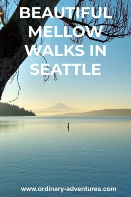
I spend a lot of time at Seward Park as it’s very close to my house. It’s one of the best walks in Seattle, although I might be biased! I love watching this park change through the seasons since I’m so familiar with it. It has a 2.5 mile completely flat paved loop takes you around the Bailey penninsula, a large penninsula in Lake Washington. If you go counter clockwise, you’ll start passing a playground and will look south towards Renton and Mt Rainier. Around the corner, facing east, you’ll be looking across the lake to the houses of Mercer Island. Rounding the north side of the penninsula, you’ll look out to the I-90 bridge and downtown Seattle. The final stretch, along the west side of the park, goes along Andrew’s Bay where there are often boats anchored. Seward park has lots of birds including great blue herons and a nesting pair of bald eagles that I see on hear on almost every visit. There are also lots of ducks and bunnies! If you venture off the loop and onto the north end of the penninsula, you can visit old growth forest right in the heart of Seattle!
Southwest Seattle: Alki Beach Park

Alki is a classic summer destination but don’t overlook it in winter! In the winter you get much more solitude and it’s easier to park. If you start at Don Aremi boat launch, you can walk along the trail above the beach (and on the beach for certain points) around to constellation park which is a flat 3 miles (6 miles roundtrip). Of course you can park and stop anywhere along there, but that’s my favorite route, with changing views of the city and Elliott Bay from seeing the Space Needle to looking across to Bainbridge and then to Blake Island and Vashon Island around the corner at Constellation park. There are lots of places to stop for a hot drink or food along the way as well. This is a great sunrise/sunset spot. Keep an eye out for seals swimming in the water and even orcas sometimes! Wildlife walks in Seattle!
Northwest Seattle: Ballard Locks to Golden Gardens

Another very popular summer destination, the Ballard Locks operates all year and is much less crowded in the winter. You can park at the locks or on the street (or park anywhere along the route to Golden Gardens, or at Golden gardens and go the other way) and check out the locks and the botanical garden before starting your walk towards Golden Gardens. It’s 2.5 basically flat (there’s a minor rise around the railroad crossing) miles (5 miles round trip) but as with alki, you can start or stop anywhere you like. You’ll walk by the Shilshole Bay Marina which is a wonderful place for boat watching (and heated bathrooms!). There are hot drinks and food available at the marina, Jibe Espresso has excellent hot sandwiches! Golden Gardens park is lovely beach just past the marina.
Northeast Seattle: Burke Gilman Trail from the University of Washington to Magnusson Park
The Burke Gilman trail in total is about 20 miles, but this is a really enjoyable almost completely flat 4 mile (8 mile round trip) walk starting from the University of Washington light rail station and going to Magnusson Park beach. As with the others, you can stop anytime you like (or go one way and take the bus back). If you were driving you could do this the other way parking at Magnusson. From the station, cross the bridge over Montlake Blvd and go to the right (north) on the Burke Gilman trail. You’ll pass along campus and behind University Village (hot drinks and food abound!) and then through neighborhoods on the trail up to Magnusson park. Magnusson is a huge park which includes a beach (on the lake this time) and an offleash dog area.
Downtown: Myrtle Edwards Park

Last but not least, let’s not forget downtown! Downtown itself of course is NOT flat, but this delightful 3 mile round trip walk in downtown Seattle is completely flat! To start the walk, go to the Olympic Sculpture Park at the north end of the waterfront. Take some time to enjoy the sculpture park, before heading along the trail through Myrtle Edwards Park. The trail goes right next to the water and through trees and grass and then goes to the Port of Seattle grain terminal, where wheat is transferred from train cars and loaded onto ships to go all over the world. There aren’t any services along the trail, but there’s food at Paddy Coyne’s pub at the beginning of the trail (and many other options along the waterfront).