Grasshopper Pass: Remote Incredible View Hike
Last Updated on September 25, 2025
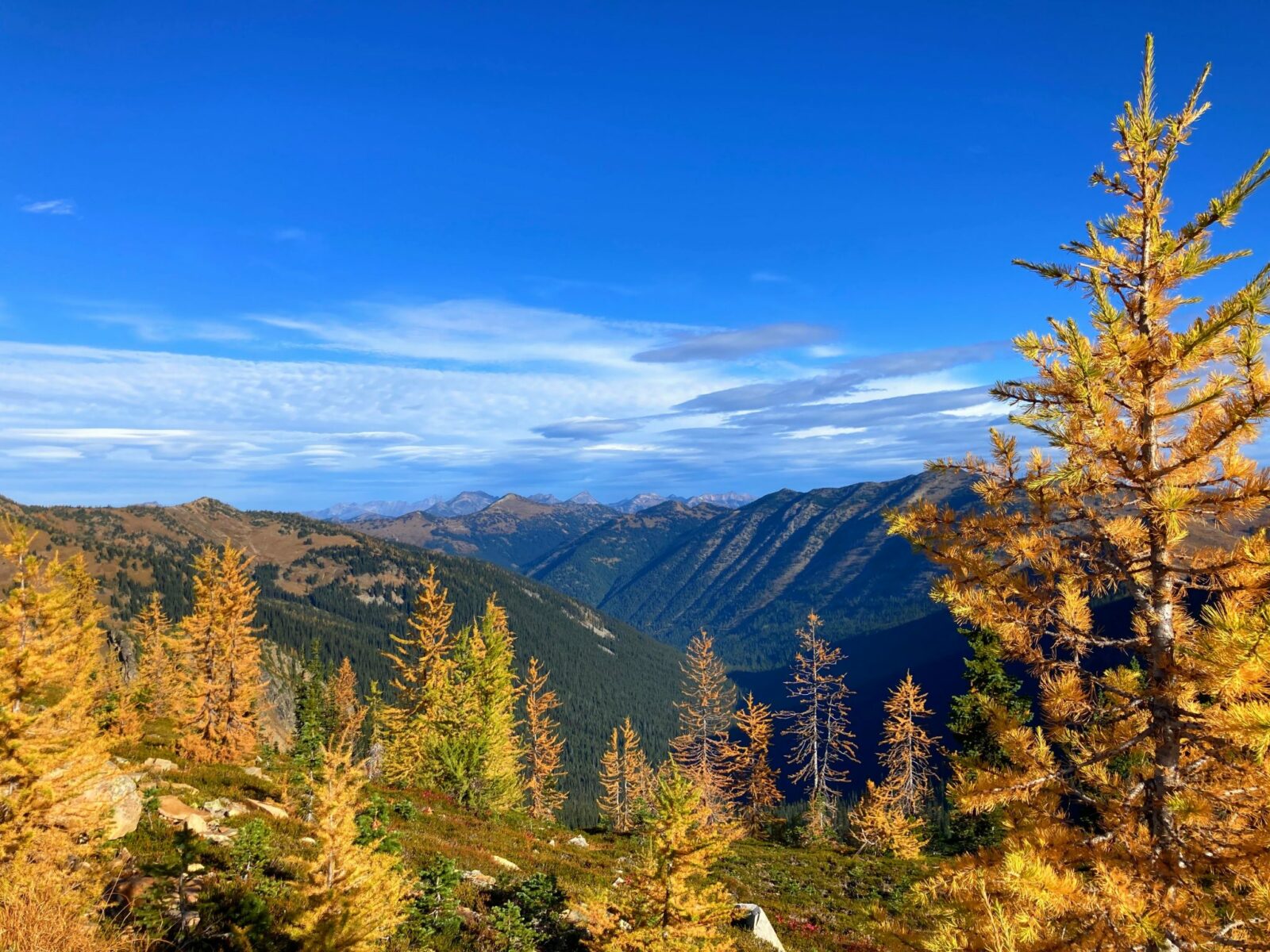
Take a life affirming hike to Grasshopper Pass, or anywhere along this gorgeous and fairly mellow section of the Pacific Crest Trail in the North Cascades! Absolutely perfect for fall with gorgeous golden larches and bright red berry bushes set against the backdrop of spectacular mountain scenery. There really are not enough superlatives for this hike! The best part is, despite the long (9.5 miles with up to 1500 feet of elevation gain) round trip to Grasshopper Pass, you can turn around at any point on this gorgeous trail and still have an amazing outing with plenty of golden larches, north cascades mountain scenery and pikas! Throughout this trail guide, I’ll include all the shorter hikes you can enjoy along this trail.
This section of the Pacific Crest Trail to Grasshopper Pass is on the homeland of the Nlaka’pamux First Nations, Syilx Okanagan and Methow people.
Parking Pass: Northwest Forest Pass
Cell phone signal: None
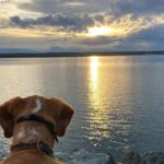
Dog Friendly: yes, on leash
Related: What to wear for a hike in the Pacific Northwest, What to bring for a hike in the Pacific Northwest
Is the Grasshopper Pass Trail right for me?
If you like spectacular views, golden larch trees in fall and less crowded trails, you will probably love the trail to Grasshopper Pass in the North Cascades in Washington State. Views surround you the entire length of this trail and it never gets to steep in this section of the Pacific Crest Trail.
If you’re intimidated by the length of the hike to Grasshopper Pass, I want to assure you that a hike of any length on this trail will be just as rewarding and you can turnaround anytime without missing out on incredible views and larch trees. Throughout the trail description I’ll mention different viewpoints and features and potential turnaround points, along with their mileage and elevation gain.
The trail itself is in excellent shape, as is typically true of the Pacific Crest Trail. There are a few rocky sections and a couple of narrow spots where the trail crosses a steep hillside. This section of the trail is not steep, although it’s not a hike uphill to a destination and then downhill back to the trailhead type of hike. There are gentle up and down sections in different places.
This hike starts high and stays high, between 6400 and 6800 feet of elevation. This means beautiful scenery the entire time, and it also means that you may find yourself breathing a little harder than you would at sea level. Take it easy and enjoy the views!
The biggest barrier to this trail is the length of the drive and the last ten miles of on a narrow dirt road. You can make it here in any car as long as you carefully navigate the potholes. Make sure you go slow enough so that you can leave plenty of room for cars going the other way and find a spot to pull over as needed.
If you’re looking for something with less driving on a dirt road and somewhat shorter distance from Seattle with similar scenery and larches, try the Maple Pass Loop (which is awesome, but much more crowded). Other fabulous North Cascades fall hikes include Blue Lake and Cutthroat Lake.
When is the best time to hike to Grasshopper Pass?
This is an amazing fall hike with the larches generally peaking here at the very end of September or early October. Grasshopper Pass is also a wonderful summer hike in late July, August and early September. Keep an eye on the weather forecast as there can be snow in September and October!

Where is Grasshopper Pass?
Grasshopper Pass is located along the Pacific Crest Trail in the Okanagan Wenatchee National Forest. The trailhead is very remote, an hour or two from a cell phone signal depending on which direction you’re coming from.
To get there, head on Highway 20, the North Cascades Highway to Mazama, about 20 miles west of Winthrop. In Mazama, turn on Lost River Road (right turn if coming from Winthrop, left if coming from the west). Just past this turn, you’ll come to the Mazama Store. If you need anything for your hike or camping trip, make sure to stop here as it’s the last place to get anything before you head up to the high country.
Leaving Mazama on Lost River Road, expect the next 15 miles to the trailhead to take close to an hour. It’s a narrow road! After a bit of pavement past some houses and a campground (and several dispersed camping options), continue on the Lost River Road which later is just called Forest Road 50.
The last 10 miles or so is dirt and very narrow. Make sure to take it slow, avoid potholes and back up to a pullout if needed when you need to pass.
About two miles before the trailhead, you’ll arrive at the Hart’s Pass Campground, turn left towards the Meadows Campground (it’s signed). In another mile, pass Meadows Campground on the left and head right up the last short and steep section of the road to the Brown Bear Trailhead for the Pacific Crest Trail.
This is a long drive for most people (unless you live in Winthrop or Twisp!) and if you want to make a weekend out of it you can camp nearby at either Meadows Pass Campground or Hart’s Pass Campground.
Grasshopper Pass Trail Description
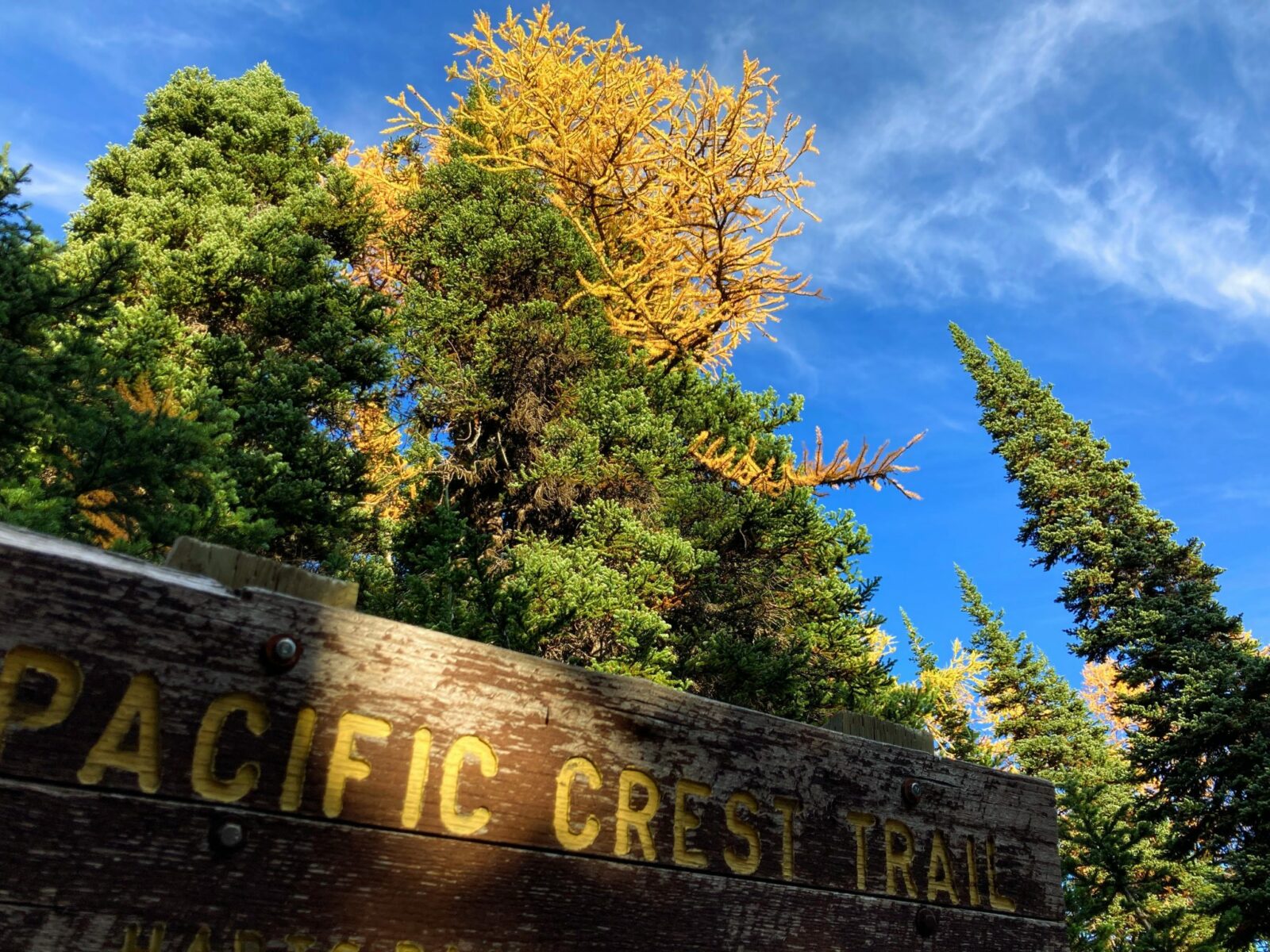
The awesomeness of the trail to Grasshopper Pass literally starts in the parking lot, with golden larch trees and views of the mountains while you’re parking! When you’re ready to hit the trail, begin hiking and head up about 30 feet on the trail to a sign marking the Pacific Crest Trail. Go LEFT here to head south on the Pacific Crest Trail.
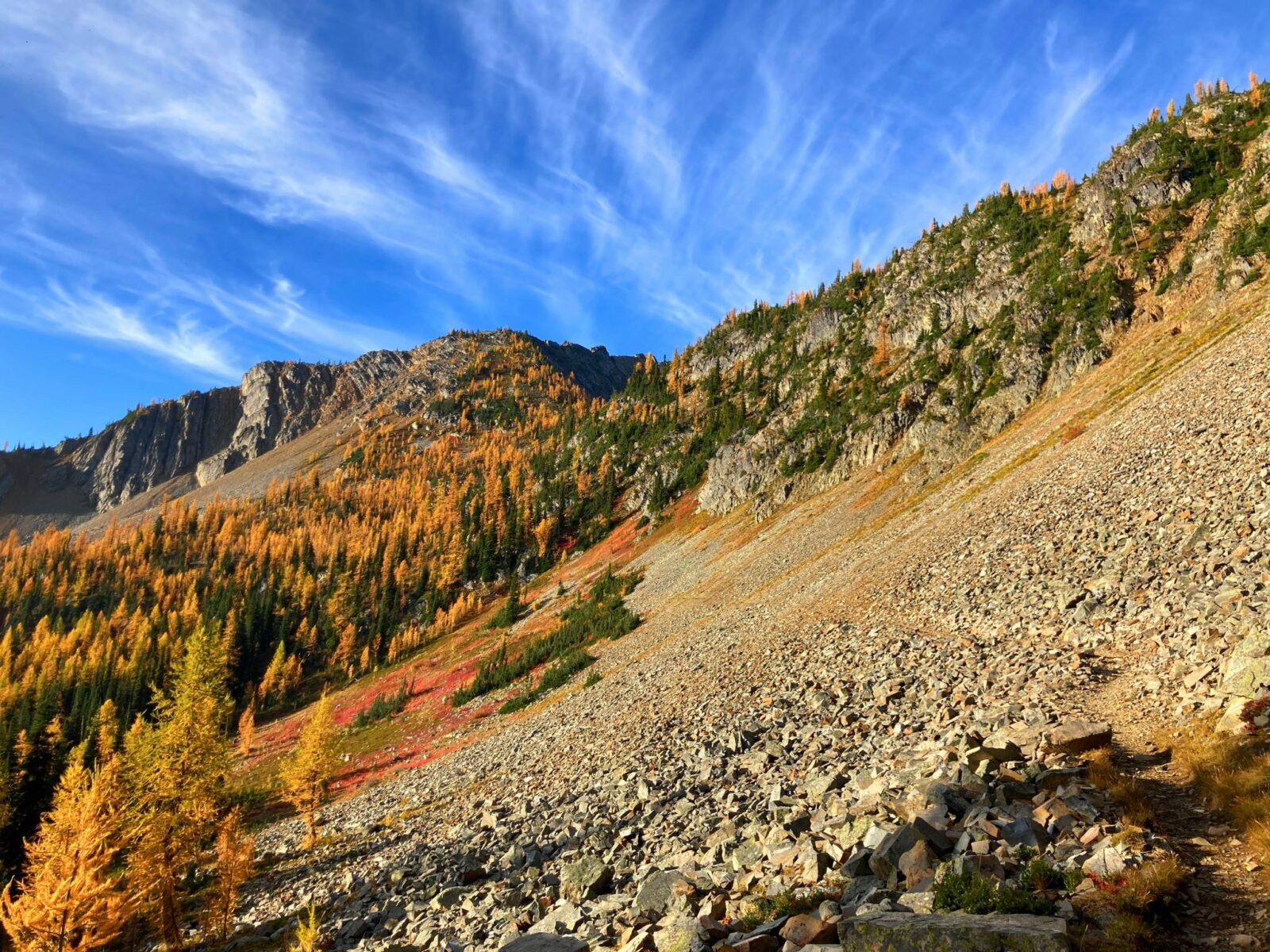
Once on the Pacific Crest Trail, you’ll quickly find yourself crossing an open rocky slope, with mountains towering above you, more golden larch trees ahead of you and you’ll probably here (and hopefully see!) the “meep! meep!” of pikas scrambling around on the rocks.
In a mere half mile you’ll find yourself in your first golden larch grove of the trail to Grasshopper Pass. You can turn around here for a 1 mile hike with minimal elevation gain.
Passing through this first grove of larches, you’ll be continuing to gently climb on the trail. About a mile from the trailhead, you’ll get your first views of the mountains to the south of the trail, including the Needles, Tower Mountain and Azurite Peak. Turn around here for a two mile round trip hike with a few hundred feet of elevation gain.
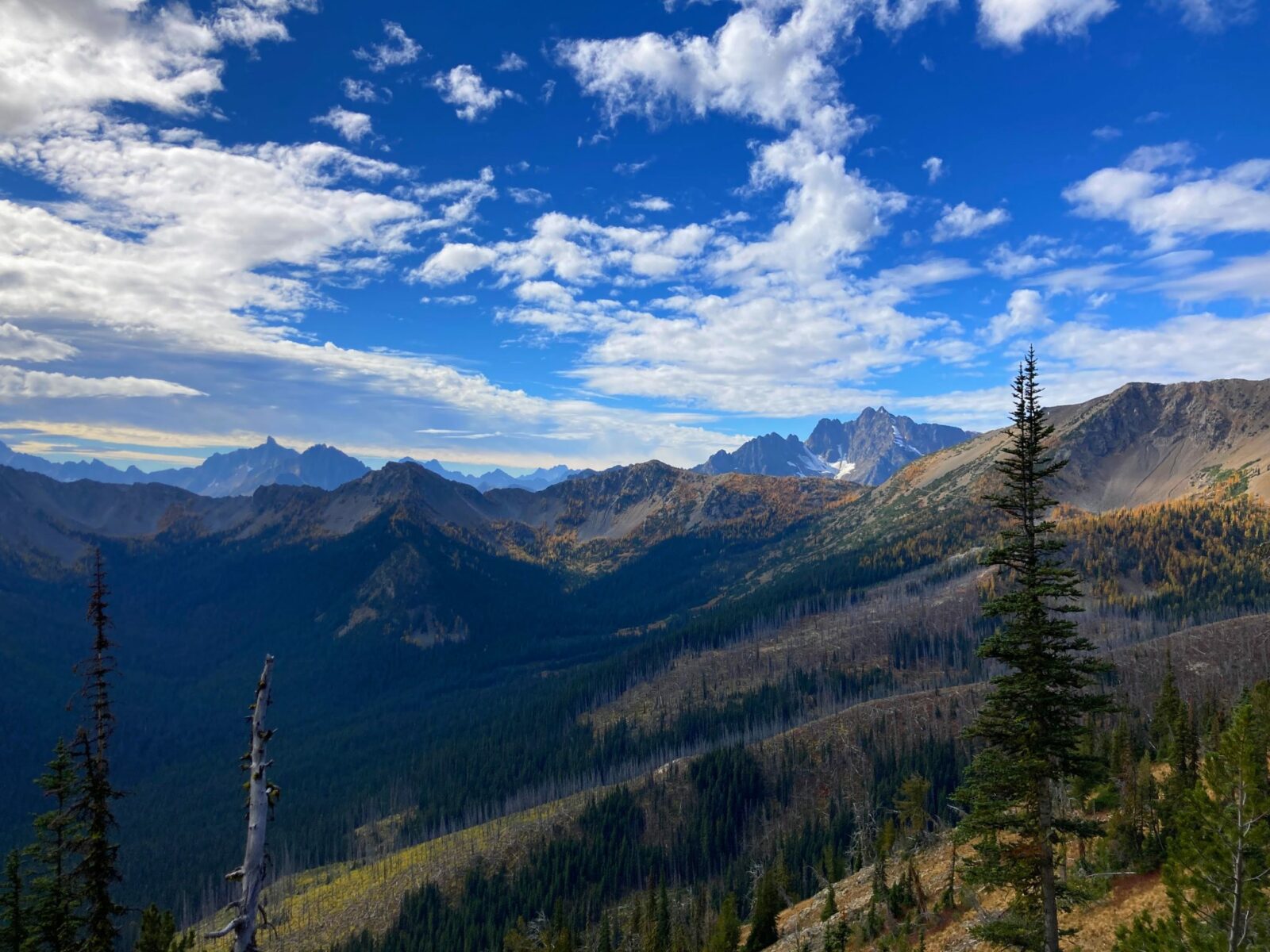
If you’re continuing on towards Grasshopper Pass, in another mile, now about 2 miles from the trailhead, you’ll come to an open flat spot with your first views in all directions! You’ll continue to have views towards the south as well as to the north where you’ll see nearby Slate Peak as well as many more distant mountains. If you’ve had enough hiking, turn around here for a four mile round trip hike with a few hundred feet of elevation gain. Want more? Grab a snack and keep going!
After this viewpoint at about two miles, you’ll gently descend slightly and then gently go up again as you pass around the side of Tatie Peak.
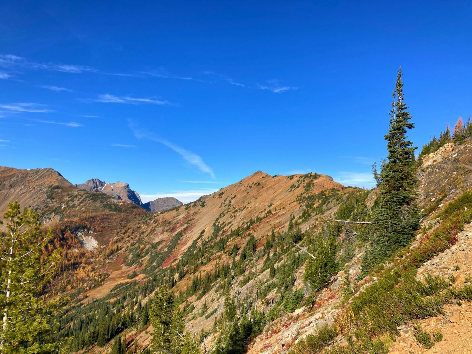
About three miles from the trailhead, on the far side of Tatie Peak, there’s a small pass offering even more views, this time including east to Mount Ballard. If you’re ready to turnaround here, your total hike will be about 6 miles with a bit over 500 feet of elevation gain.
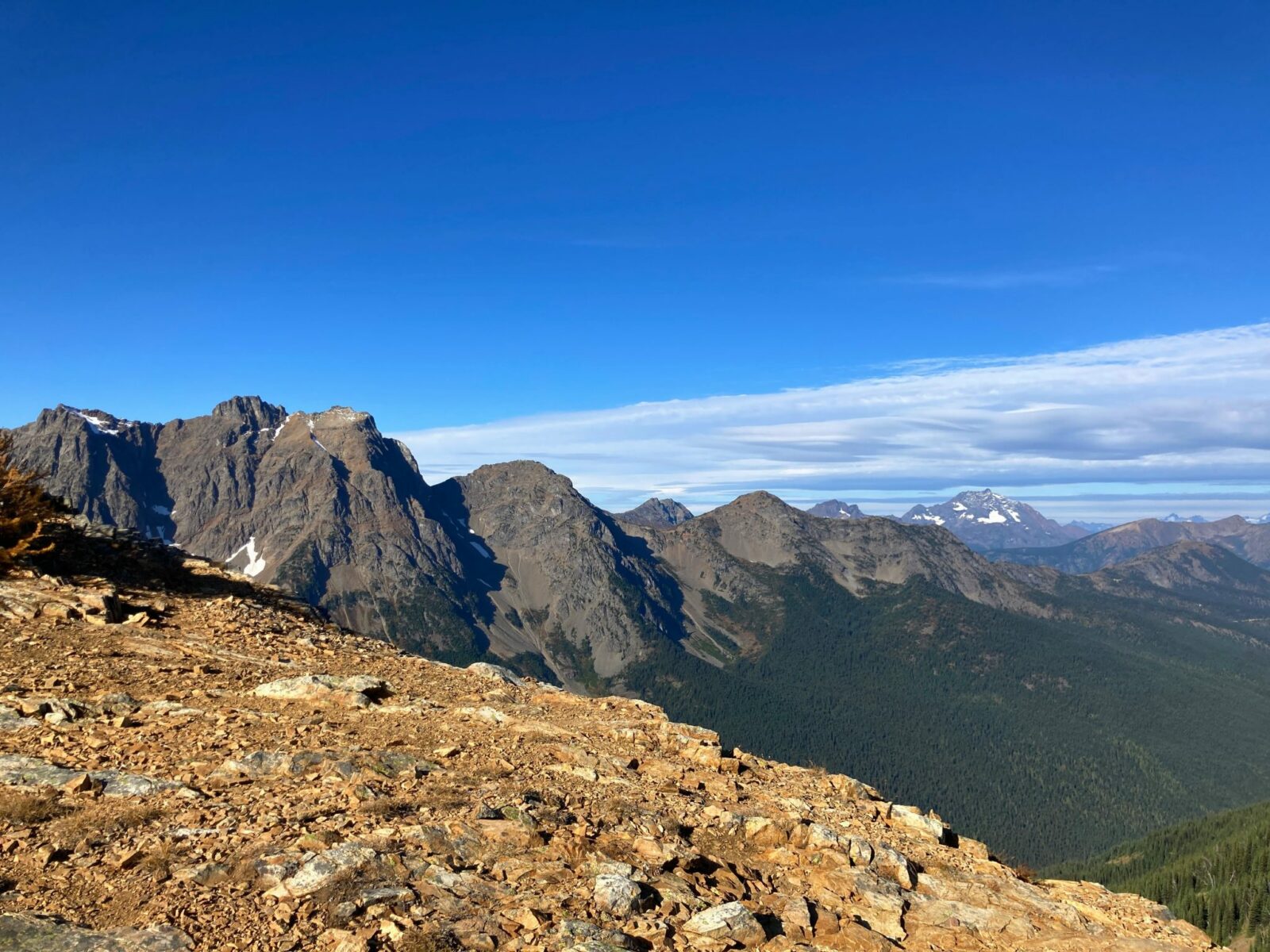
If you’re up for going a bit further, the most beautiful golden larch grove on this section of the Pacific Crest Trail is just ahead! The trail continues on a flat section through some larches and berry bushes and then begins a gentle descent through a couple of switchbacks and across a giant rock field. On the far side of the rock field, about 3.5 miles from the trailhead, enter a magical golden larch grove. Stroll through this larch grove for about half a mile while gently climbing again.
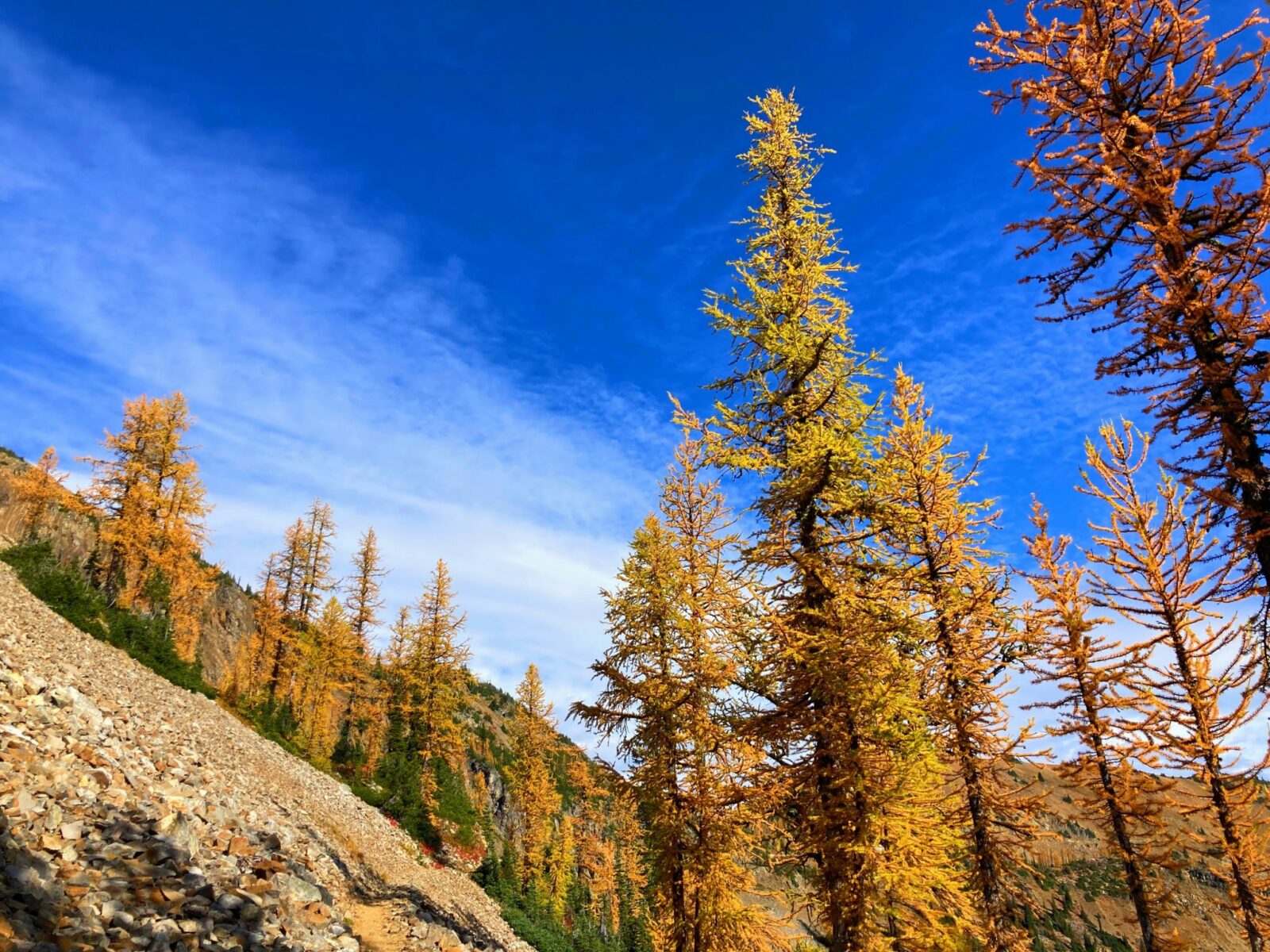
After this larch grove, you’ll continue to gently climb up with open views again to the mountains all around. You can turn around here for an 8 mile hike with just over 1000 feet of elevation gain, or you can continue another just over a half mile of gentle climbing to Grasshopper Pass. At Grasshopper Pass, you’ll encounter EVEN MORE mountain views and YET ANOTHER grove of golden larches! If you haven’t turned around before this point, make sure to take a break, get some food and then head back to the Brown Bear Trailhead for a total hike of 9.5 miles and 1500 feet of elevation gain!
Wherever you decide to turn around, somehow you’ll see even more views on the trail you just hiked, now that you’re going in the other direction! Take all the snack and picture stops you like on the hike back, you can never have too many pictures on the Grasshopper Pass trail! It’s impossible.
Bakeries and Breweries nearby
Try the Mazama Store for bread, coffee and baked goods! It’s a classic general store too and a fun place to check out when you’re in the area.
In Winthrop, try the Old Schoolhouse Brewery for beer and food and the Rocking Horse Bakery for coffee, soups and sandwiches! Looking for pizza? Check out East 20 Pizza.
Electric Vehicle Charging
The closest fast charging is 140 miles away in Burlington, which is too far for the range of my Nissan Leaf. There is charging for Teslas only at the Sun Mountain Lodge which is about 50 miles from the trailhead and 10 miles off highway 20. Also make sure you are up for taking your EV on a 10 mile stretch of dirt road and that it has good tires!

Related posts: