Boulder River Trail: Stunning Forest and Waterfalls
Last Updated on December 9, 2024
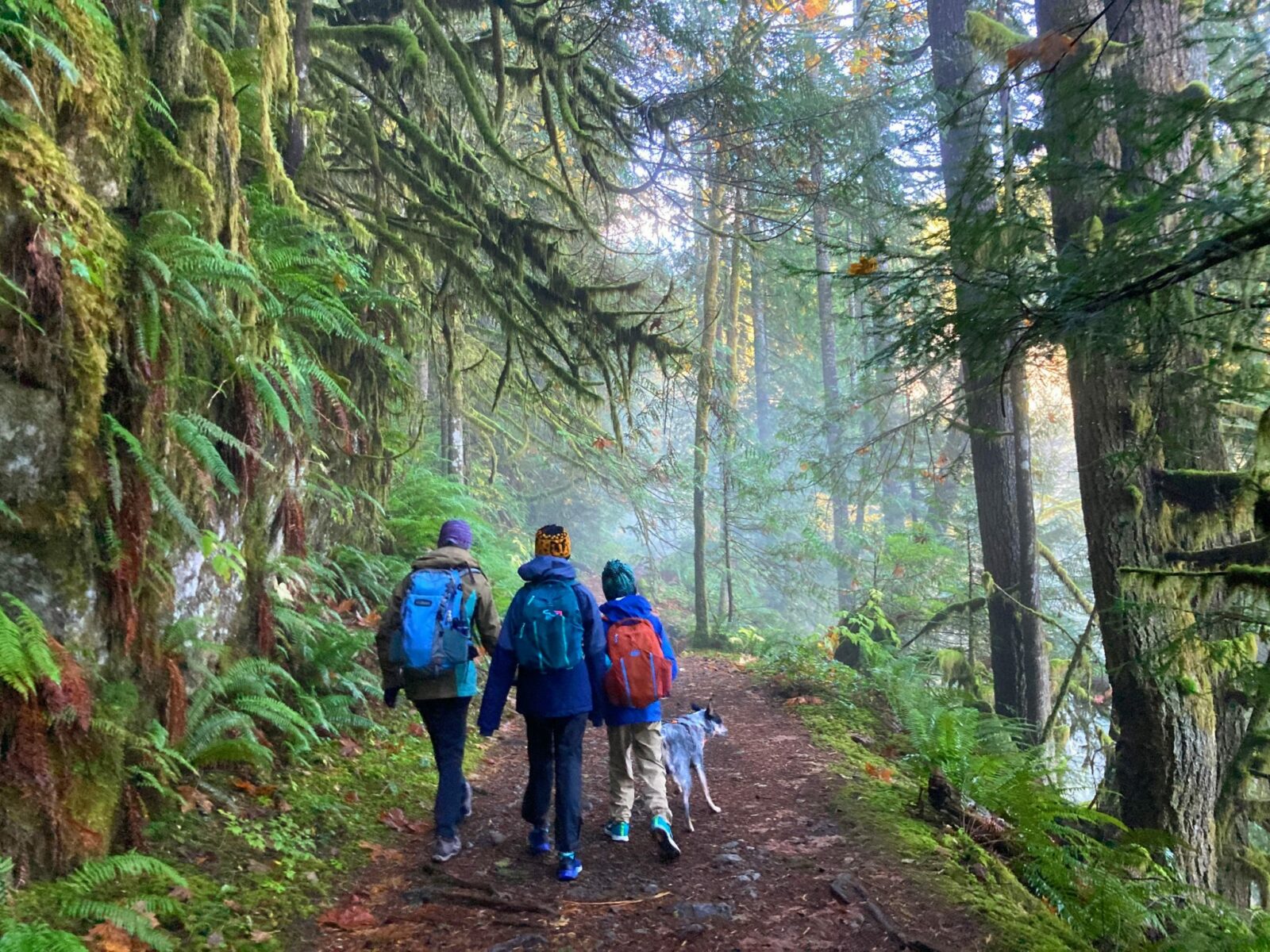
The Boulder River Trail is a magical Pacific Northwest forest fairyland along a rushing river that makes for a wonderful hike all year. You can amble along this delightful trail through the Mt Baker Snoqualmie National Forest for up to almost 5 miles. You also can go a shorter distance (three miles round trip) to one of the most beautiful waterfalls in Washington State. The Boulder River trail hike is up to 9 miles round trip with 800 feet of gentle elevation gain. You’ll see waterfalls, old growth forest, ferns, moss and the river on rainy and sunny days alike.
The Boulder River Trail is the homeland of the Snohomish, Skagit, Stillaguamish and other Coast Salish people.
Parking Pass: None
Dog Friendly: yes, on leash
Related: What to wear for a day hike in the Pacific Northwest, what to bring for a day hike in the Pacific Northwest
Is the Boulder River Trail right for me?
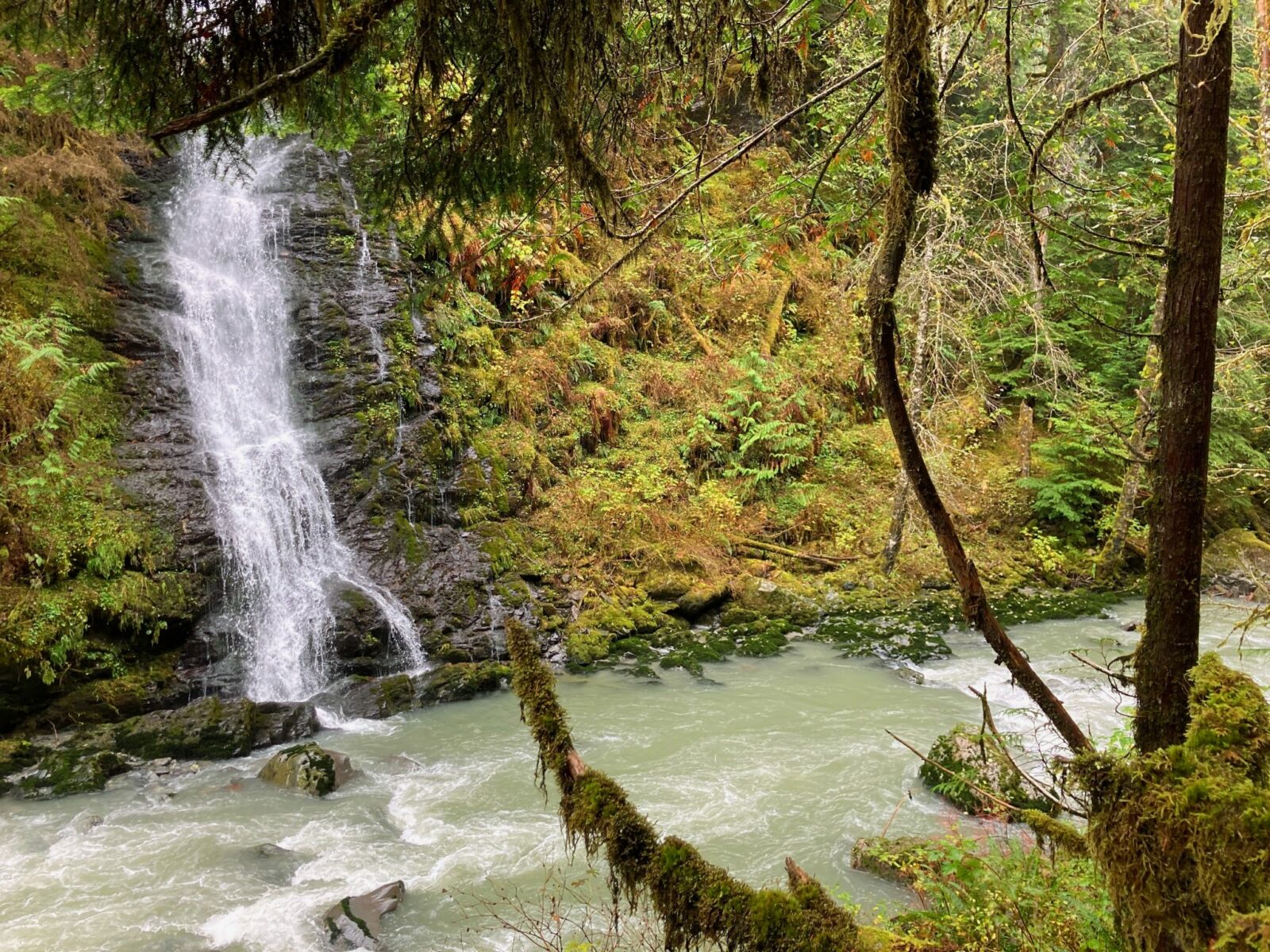
If you love forest hikes and waterfalls you MUST do this trail! The Boulder River Trail ambles through the forest trading the rush of city noise for the rush of river noise. It has several gorgeous waterfalls, the most spectacular one is just under a mile and a half into the hike.
This trail isn’t steep, there are some sections where it goes gently uphill, but never steeply. For the most part the trail is in good condition and has a lot less mud than you might expect. There is still some mud so be ready for that. Some sections of the trail are quite rocky or involve climbing over or under a log from fallen trees. There are notches to help you get over the biggest logs but you will probably need to use your hands to help you over.
Some sections of this trail have small creeks or other water covering the trail. They aren’t deep but waterproof footwear or excellent rock hopping skills are necessary!
This hike is much less crowded than many other hikes near Seattle, such as Twin Falls and Wallace Falls, though it does get a little busy on summer weekends. If the winter you definitely won’t see many other people!
When is a good time for the Boulder River Trail
The Boulder River is an excellent year round hike in pretty much any weather! The only time I wouldn’t head out on this trail is if it was super windy, since there are so many big trees.
Other than that, in summer it’s a refreshing shady hike and on rainy days or winter, the beauty of the forest and the waterfalls will take your breath away.
Like most waterfalls in Washington, the waterfalls along the Boulder River Trail are most spectacular in spring (March-May) and late fall (November and December).
Where is it?
The Boulder River Trail is located in the Mt Baker Snoqualmie National Forest, between Arlington and Darrington.
To get there, from I-5, take the exit for Highway 530 in Arlington. Follow Highway 530 east through some odd turns through town and out of town towards Oso. In about 20 miles, after passing through Oso and the Memorial of the catastrophic 2014 landslide, turn right on French Creek Road (Forest Road 2010). When you get to the road it definitely looks like someone’s driveway, but you’re in the right place.
The road quickly turns to gravel and has quite a few potholes. The potholes are fairly easy to drive around as long as you take it slow and pay attention to going around them. A little less than 4 miles on, the road dead ends at the Boulder River Trailhead. The parking area is small, but this trail is not particularly crowded so parking should be easy.
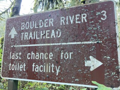
NOTE: there are no outhouses at the trailhead! There is a pit toilet along the road, watch for the very appropriate sign.
Boulder River Trail Description
The Boulder River Trail starts with a mostly flat mile of wide trail through the forest. You’ll here the crashing of the river right away and that will continue throughout the hike.
In about a mile, you’ll do some gentle climbing and cross a photogenic single log wooden bridge.

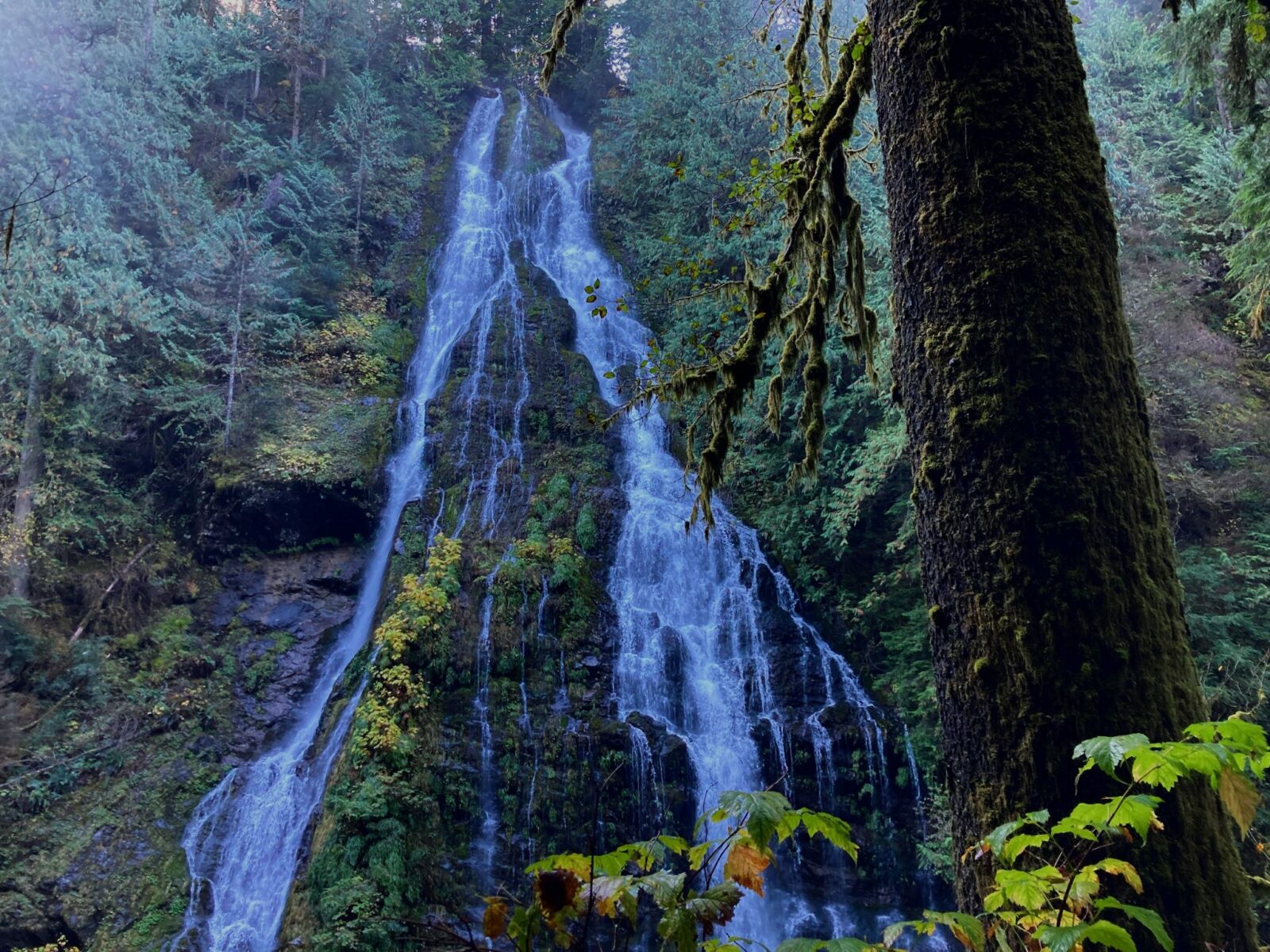
Just under a mile and a half from the trailhead you’ll come to stunning Boulder River Falls. The waterfall tumbles down a sheer cliff covered in ferns and moss and drops into the Boulder River. There is a short but steep and rocky side trail here which goes down to the river directly across from the base of the falls. You don’t need to scramble down there to see the falls. They are pretty incredible right from the main trail!
If you’re looking for a shorter hike, you can turnaround at this point for a 3 mile round trip hike. If you’re up for more hiking, continue on this beautiful trail.
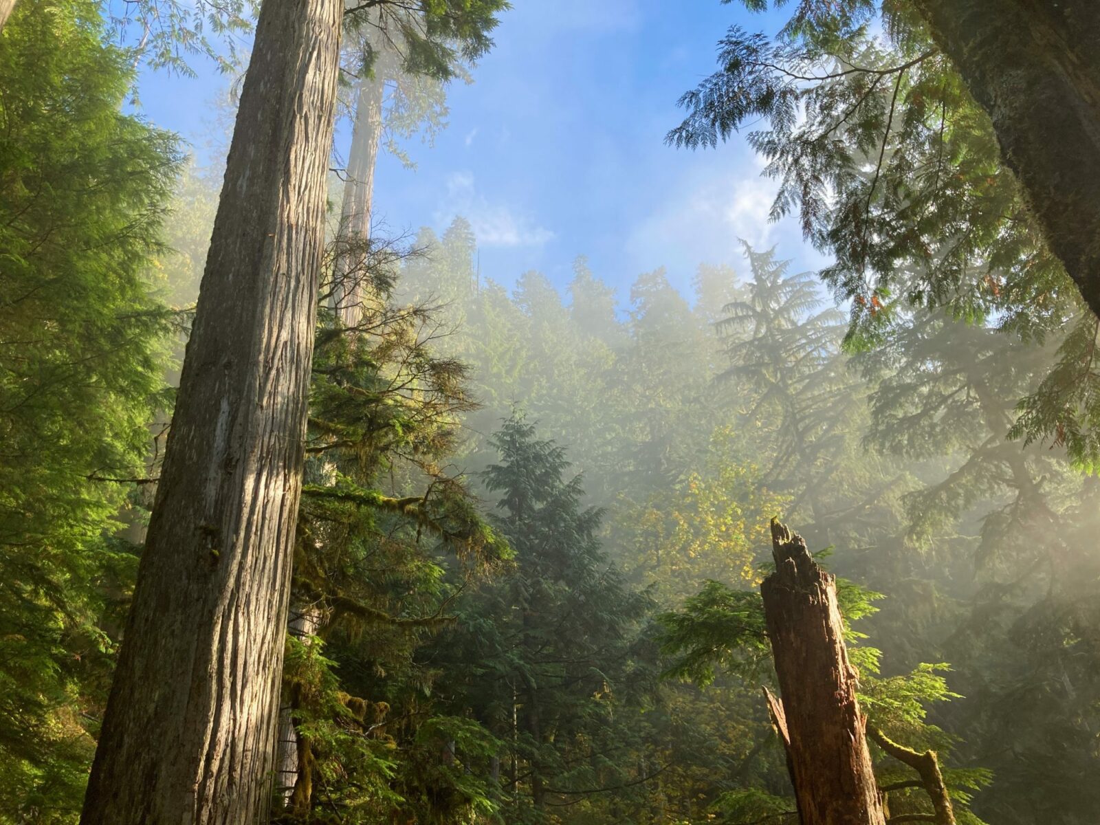
After Boulder River Falls, the trail climbs a bit more through the forest above the river. In this section you’ll start to see more old growth trees. Take your time to soak in these centuries old giants as you hike along. You’ll also encounter more rocks and roots in this section.
In another mile and a half, three miles from the trailhead, you’ll come to another beautiful waterfall. This one is not as high as the earlier one, but it’s also absolutely stunning. Just below the trail here there is a small clearing with several logs, making this an ideal lunch spot next to the waterfall and the river.
At this point, you can turn around for a 6 mile round trip hike. If you’d like to continue on, you can go an additional mile and a half through the forest and along the river. After this point, the trail basically ends. In the past it continued on but isn’t maintained beyond this point at all. There is a wider and bigger area here to hang out by the river for a bit (or camp if you came for an overnight backpacking adventure!). If you go this far you’ll do just under 9 miles round trip.
However far you decide to go on the Boulder River Trail, make sure to take your time so you can soak up the forest beauty, the wildness of the Boulder River and the bajillion ferns and mosses you’ll encounter along the way!
Bakeries and Breweries near the Boulder River Trail
Try the Chaotic Bakery in Arlington or Hanky Pies in Granite Falls, featuring hand pies as well as other baked goods, coffee, breakfast and lunch.
For the nearest brewery, check out Skookum Brewery in Arlington or the Lake Stevens Brewing Company
Electric Vehicle Charging
The nearest fast charging is at the Angel of the Winds Casino near Arlington (Teslas only), 28 miles from the trailhead.
The nearst fast charging for CHAdeMO (most non Tesla EVs) is at the Seattle Premium Outlets on the north side of Marysville, 35 miles from the Boulder River Trailhead.
The trailhead is 70 miles from Seattle, so depending on the range of your EV and where you’re starting, you might be able to do the Boulder River trail without needing to charge.
Related posts:


