7 Surprisingly Awesome Hikes in Bellevue
Last Updated on February 22, 2024
There are a number of fantastic hikes in Bellevue! This may come as a surprise to those who associate Bellevue with affluent suburbs, freeways, Microsoft and shopping malls. If that’s you, give Bellevue another look and don’t miss out on the wonderful hikes in Bellevue that are really easy to get to. Many are accessible by transit. These hikes are all great options year round, perfect for short winter days or after work on long summer evenings. Ready for peaceful forests, bubbling creeks, rushing waterfalls and interesting historical artifacts? Read on!
Hikes in Bellevue are a wonderful middle ground between the urban trails of Seattle and the further away hikes in Issaquah and North Bend.
Bellevue is the homeland of the Duwamish and other Coast Salish people.
Dog Friendly: All these hiking trails and parks allow dogs as long as they are kept on leash. The one exception is the barnyard at Kelsey Creek Farm. Dogs are permitted on leash in the park, but not the barn where the farm animals are.
Parking Pass: None of these hikes in Bellevue require a parking pass or fee.
- Coal Creek Falls Loop
- Wilderness Peak
- Margaret’s Way
- Mercer Slough
- Coal Creek Natural Area
- May Creek Park Trail
- Lake to Lake Trail
Coal Creek Falls Loop Trail
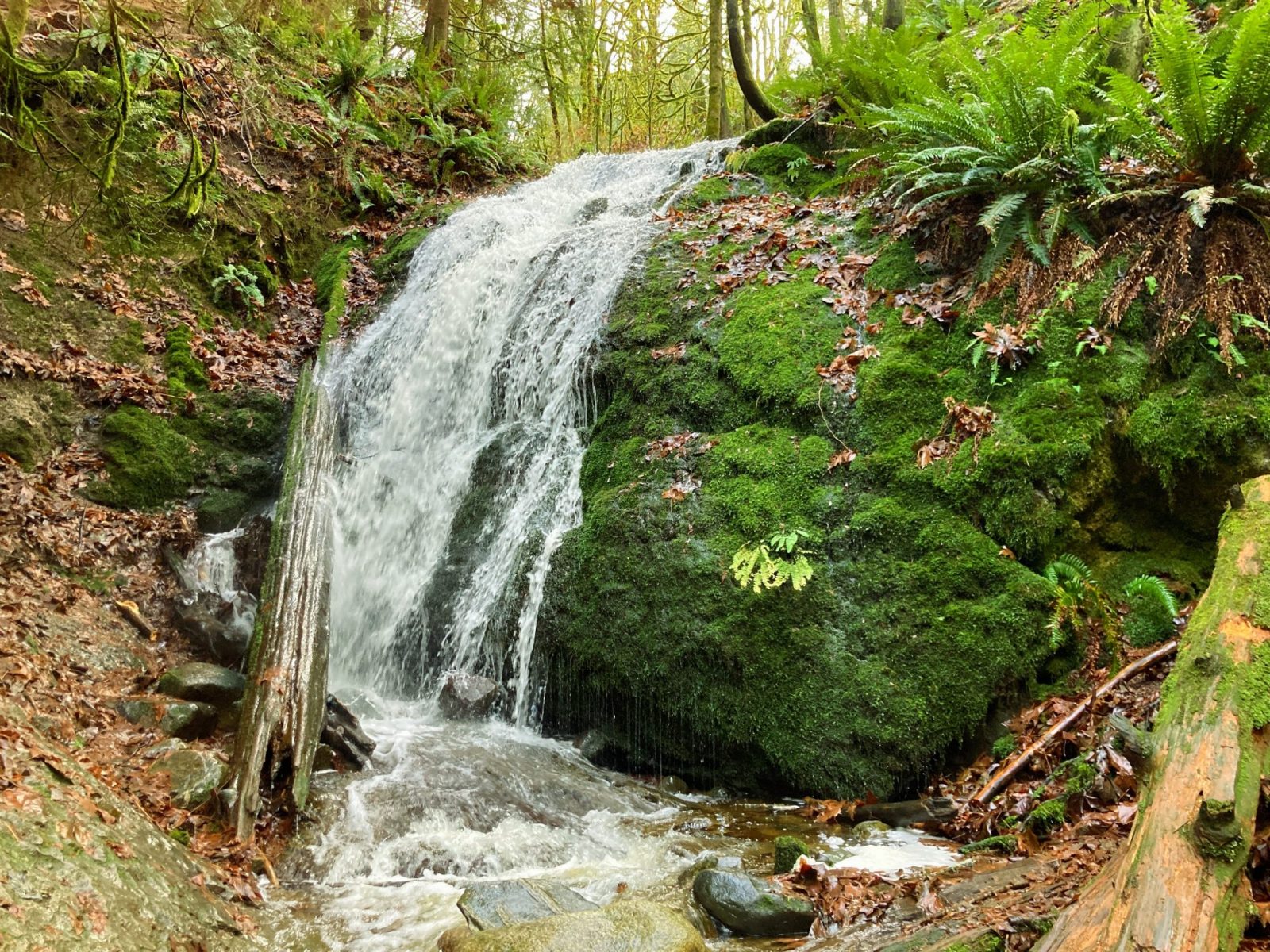
- Best For: Coal Creek Falls is the best waterfall hike in the city and one of my favorite hikes in Bellevue. You can expand this hike to as many miles and as much elevation gain as you want since it’s part of the Cougar Mountain Wildland Park trail system. You can also just go a shorter distance to Coal Creek Falls.
- Distance: 3 mile loop (or much more linking up to additional trails)
- Elevation Gain: 400 feet (or more linking up to additional trails)
- Where it is: The Redtown Trailhead in Cougar Mountain Regional Wildland Park is located on Lakemont Boulevard in Bellevue. It is just east of the Newcastle Golf Course.
- Transit: There is not easy transit access to this trailhead, however you can start from the Sky Country Trailhead instead which is served by the Trailhead Direct Bus when it is in service.
- Parking: The Red Town Trailhead gets very busy on weekends and fills up quickly. Try the Sky Country Trailhead instead, which has a bigger parking lot. Parking is free.
Wilderness Peak Trail
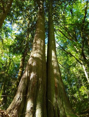
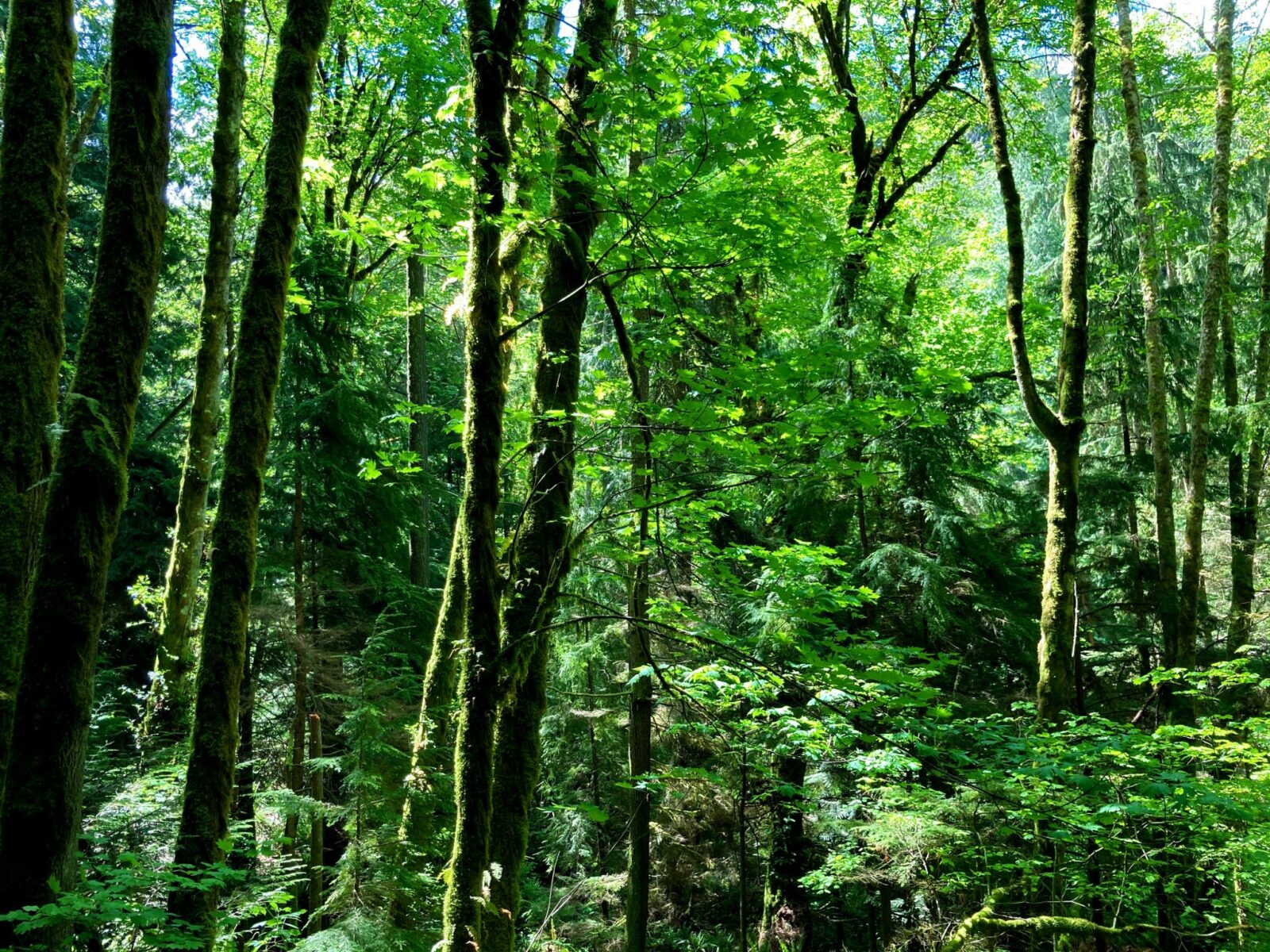
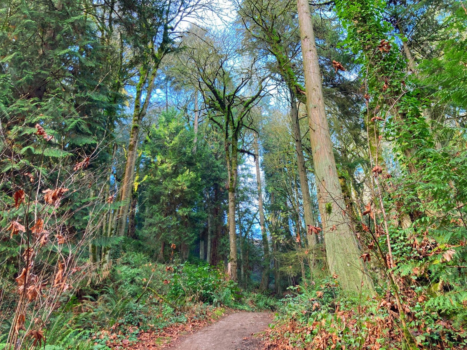
- Best For: Wilderness Peak is a good workout in a beautiful forest on a loop trail. This feels like a hike much farther from the city than it is! The forest has old growth trees along the route. There’s not a view on this “peak” but you’ll love the shady forest on a hot day, or the dripping trees on a rainy day.
- Distance: 4 miles
- Elevation Gain: 1200 feet
- Where it is: The Jim Whittaker Trailhead is located on the southeast side of Cougar Mountain Regional Wildland Park.
- Transit: The Jim Whittaker Trailhead is across the road from the Margaret’s Way Trailhead, which is served by the Trailhead Direct Bus when it’s in service.
- Parking: This parking lot is really small! Try to arrive early in the morning or late in the day to find a spot.
Margaret’s Way Trail
- Best For: Margaret’s Way is the longest of the hikes in Bellevue, and has the most elevation gain. This is an absolutely beautiful forest hike and leads to a gorgeous view of Mt Rainier.
- Distance: 7 miles round trip
- Elevation Gain: 1500 feet
- Where it is: The Margaret’s Way trailhead is located across from the Whittaker trailhead described above. It is between Bellevue, Renton and Issaquah on the west side of Squak Mountain.
- Transit: The Margaret’s Way trailhead is served by the Trailhead Direct bus when it’s in service.
- Parking: The parking lot is decent sized, but it still fills up on weekend days. Get there early or late in the day to find parking.
Mercer Slough Nature Park
- Best For: Even though this post is about hiking, this is an excellent place to canoe or kayak! The park has waterways all through it that are perfect for calm water exploring and looking for ducks! You can even rent canoes and kayaks nearby. As for hiking, this is a wonderful marsh area to explore, as well as forests and wetlands. There are birds and lots of plants. This trail system is especially wonderful in the spring when everything is greening up! Even though much of these trails are smooth, flat and/or boardwalked, there are sections that are steep or rocky for a short distance to get in and out.
- Distance: Over 5 miles of trails, a 4 mile loop and a 1 mile loop
- Elevation Gain: Minimal
- Where it is: Just north of I-90 and just west of I-405. At the time of this writing, the west side of the park is inaccessible for driving and parking because of the light rail station construction, a multi year project.
- Transit: Mercer Slough is very near the South Bellevue Park and Ride.
- Parking: Normally there are large parking lots on the west side of the park. At the moment you’ll have to park on the east side, due to construction. Parking is limited at the moment.
Coal Creek Natural Area
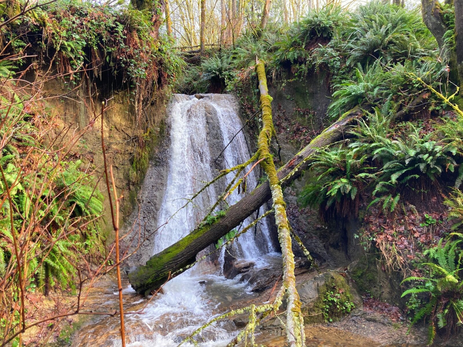
- Best For: Solitude, urban waterfalls and beautiful forest! There are several miles of trail here that are graveled, flat and wide on an old railroad bed. The YMCA trailhead is the best one to keep the experience as flat as possible. There are still a few short hills to navigate, but not much. If you want more hills, you can take the trails down into the ravine below. The Coal Creek Natural Area also has lots of interesting interpretive signs related to the coal mining history of this area. This is another of my personal favorite hikes in Bellevue because of the solitude and peaceful forest and creek. If you want a longer hike here, you can continue on to the Redtown Trailhead in Cougar Mountain Regional Wildland Park.
- Distance: Up to 5 miles
- Elevation Gain: Up to 400 feet (can make it mostly flat by staying along the old rail trail between the YMCA trailhead and Lakemont Boulevard).
- Where it is: Just west of Cougar Mountain Regional Wildland Park, between Bellevue and Newcastle.
- Transit: From the Eastgate Park and Ride, take Metro #245 to Coal Creek Parkway and Factoria Boulevard. From here, it’s less than a mile to the trail.
- Parking: There are several trailheads with parking lots, including the one on Coal Creek Parkway, which is where I like to start.
May Creek Park Trail
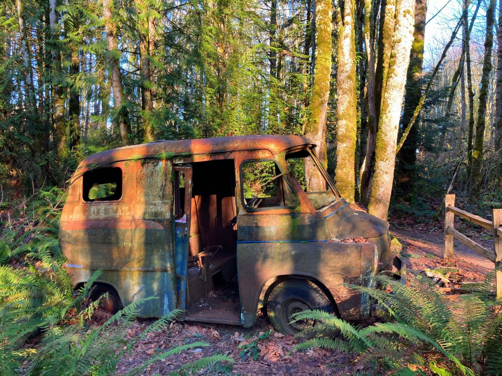
- Best For: Bubbling May Creek, a beautiful forest and an interesting, photogenic old truck. This trail has lots of logs to explore and while it has steep sections, the trail is in excellent condition, mostly free of rocks and roots.
- Distance: Up to 3.5 miles
- Elevation Gain: Up to 200 feet
- Where it is: Newcastle, the south side of Bellevue
- Transit: From the downtown Bellevue Transit Center or the Eastgate Park and Ride, take Metro #240 and get off at Coal Creek Parkway and SE 89th, about half a mile from the trail.
- Parking: This only space for a few cars at the entrance to the park, the best parking option is a half mile away at Lake Boren Park, which also has restrooms. From here, you can walk up the hill 100 yards, then cut over on a utility road to May Creek.
Lake to Lake Trail
- Best For: The Lake to Lake Trail perfect for a longer hike or run or a short hike or run around one of the many parks connected by this trail and greenspace. There is a ton of variety on this trail from lakes to forests to creeks to views of Mount Rainier and Mt Baker, along with other mountains. This is sort of cheating because it’s one connected greenspace but can be split up into lots of smaller hikes in Bellevue!
- Distance: 10 miles one way
- Elevation Gain: Up to 500 feet
- Where it is: The trail links parks and greenspaces along with some sections of road walking from Lake Washington to Lake Sammamish. Refer to the City of Bellevue Parks website (linked above) for different starting and ending points
- Transit: Most of the possible starting and ending points are accessible by transit. Use Google maps to enter where you’d like to start for transit directions, or see bus routes in the sections below.
- Parking: Parking is limited at many of the parks along this route. Fortunately, there are lots of options for places to start! Use the parking lots at the various community parks along the route, or use street parking. If parking on the street, make sure you are not blocking any driveways, intersections or mailboxes and you are following all parking signs.
Highlights along the Lake to Lake Trail
Bellevue Botanical Garden
Free to visitors, the garden is especially wonderful in spring, featuring lots of gorgeous flowers! There are two miles of park trails around the garden and inside Wilburton Hill Park. There is a parking lot here and you can also take Metro #271 from the Bellevue transit center to a half mile from the garden entrance.
Kelsey Creek Park and Farm
Kelsey Creek Farm is a unique city park and a wonderful stop especially for kids. There is an awesome playground and farm animals to visit at this historic farm and step back into a different time in Bellevue’s history. This is a very busy and popular park! There is a parking lot here and you can also take the bus to within a mile of the farm (several bus routes depending on which direction you’re coming from).
Lake Hills Greenbelt
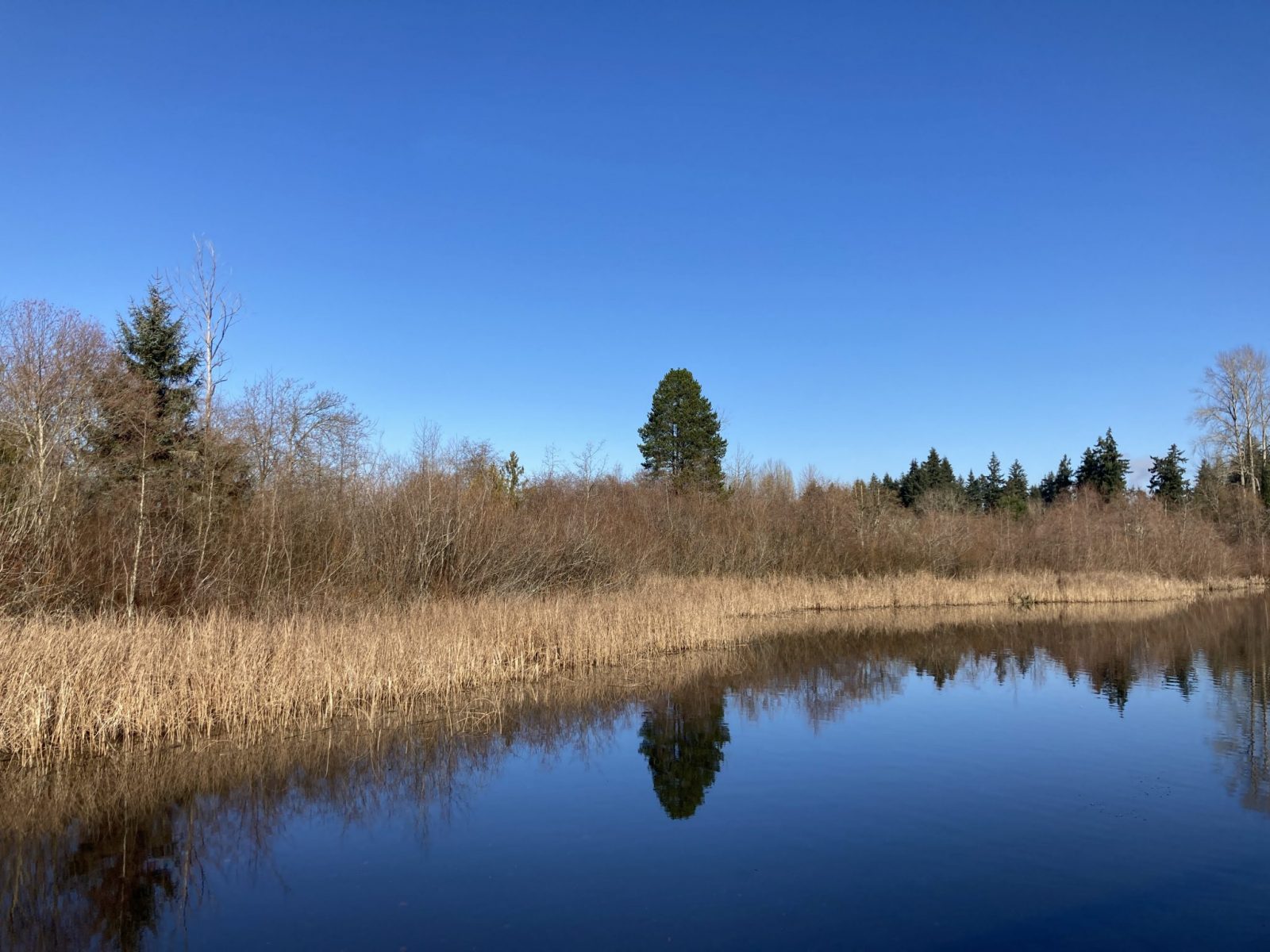
Lake Hills Greenbelt includes over three of miles of trails between two smaller lakes and is mostly wetland, making it a great place to see birds. There are ranger guided walks on nature trails and gardening workshops offered. There are several parking areas on different sides of the greenbelt. Several bus stops are within a mile of the park.
Phantom Lake
Phantom Lake includes a small parking area with restrooms and a wide, graveled, short and easy trail leading to a viewing platform by a ramp. This is a wonderful place to look for ducks and herons, along with other birds. The Metro #221 bus from the Eastgate Park and Ride gets you about a quarter mile from Phantom Lake.
Weowna Park
Weowna Park is one of the best forested hikes in Bellevue all on it’s own! A 3.5 mile lollipop loop with several hundred feet of elevation gain through a gorgeous forest and along some creeks waits for you here. You can park on the west side of the park or the northeast side along Lake Sammamish. The Metro #221 bus from the Eastgate Park and Ride takes you right to the west side of the park.


Related posts:


