Top 20 Mellow Hikes near Seattle from a Seattleite
Last Updated on June 11, 2025
Looking for a fantastic hike near Seattle but confused about all your options? Are you a beginner looking for hikes that aren’t extremely steep? I’ve got you! I’m a born and raised Seattleite and have loved hiking here my whole life. These are my Top 20 mellow hikes near Seattle.
I’m describing them as mellow rather than easy, since easy is a very subjective term and also implies that a less steep hike might be less worth it and I can assure you that’s not true. Our beautiful forests, rivers, waterfalls, beaches and mountains are stunning no matter how long or short you hike or how steep it is.
All the hikes on this list are less than 8 miles long and have 1000 feet of elevation gain or less. This means I’ve left out a few very popular hikes, including Lake 22, Mt Si, Wallace Falls, Poo Poo Point and Snow Lake. These are wonderful hikes that are super worth it if you’re up for a more challenging hike.
These hikes near Seattle are all a two hour drive or less. If it’s more than a two hour drive, I wouldn’t call it “near”. I included a few options in Olympic National Park and North Cascades National Park at the end of the article, which are further away but absolutely worth the drive.
Hiking is popular in Seattle and dealing with crowds and finding parking at trailheads is often an issue. I’ve included some tips for managing this and have also included several hikes that are not crowded.
- Maury Island Marine Park – Vashon Island
- Coal Creek Falls – Bellevue
- Tradition Lake Loop – Issaquah
- Cedar Butte – North Bend
- Middle Fork Snoqualmie River – North Bend
- Twin Falls – North Bend
- Franklin Falls – Snoqualmie Pass
- Denny Creek Trail – Snoqualmie Pass
- Talapus Lake – Snoqualmie Pass
- Bridal Veil Falls – Highway 2
- Barclay Lake – Highway 2
- Ebey’s Landing Loop – Whidbey Island
- Bowman Bay Loop – Deception Pass State Park
- Oyster Dome – Bellingham
- Carbon River Trail – Mt Rainier National Park
- Naches Peak Loop – Mt Rainier National Park
- Discovery Park – Seattle
- Seward Park – Seattle
- Cowiche Canyon – Yakima
- Bonus – Olympic National Park
- Bonus – North Cascades National Park
Related: What to wear for a hike in the Pacific Northwest, what to bring on a hike in the Pacific Northwest
Maury Island Marine Park – Vashon Island
This gorgeous park has forests, views and a secluded beach. The trail getting down to the beach is very steep for a short distance (half a mile). If you do the loop, there are some steeper/rougher sections on the way back up, or you can retrace your steps up the wide (though still steep) closed gravel road.
- Location: Maury Island Marine Park is one of the excellent hiking options on Vashon Island and is a King County Park. Vashon Island is the homeland of the Suquamish and other Coast Salish people. The distance from Seattle or Tacoma varies quite a bit based on the ferry wait and the ferry schedule. You can also take public transit (King County Metro is on the island) or bike if you’re not driving.
- Best time of year: This is an excellent year round hike. I like to do it on a sunny day since the views are incredible.
- Length: 2.5 mile loop
- Elevation Gain: 400 feet (down on the way out, then back up)
- Passes Needed: None
- Dog friendly: Yes, on leash
- Cell phone service: Good
- Restrooms: Pit toilet
- Crowd avoiding tip: This hike is never crowded, hooray!
- EV charging nearby: There are not any fast chargers on Vashon Island yet at the time of this writing, but there are several Level 2 chargers and if you’re in the Seattle area you probably won’t need to charge to come here.
- Best place to stop after: Camp Colvos Brewing (taproom) and/or Snapdragon (vegetarian sandwiches and baked goods)
Coal Creek Falls – Bellevue

Coal Creek Falls is one of the most beautiful places in Cougar Mountain Regional Wildland Park. There are many additional miles of trails here to add on to this hike if you want more miles.
- Location: Coal Creek Falls can be accessed from either the Redtown or Sky Country Trailheads in Cougar Mountain Regional Wildland Park on Duwamish and Snoqualmie lands. It’s about a 30 minute drive from Seattle. The Sky Country Trailhead is served by the Trailhead Direct bus in the summer.
- Best time of year: Late fall through late spring – Cougar Mountain Regional Wildland Park is an excellent year round hiking destination. Coal Creek Falls is usually dry from mid to late summer until fall rains arrive.
- Length: 3 mile loop from the Redtown Trailhead (2 mile out and back from Sky Country)
- Elevation Gain: 400 feet
- Passes Needed: None
- Dog friendly: Yes, on leash
- Cell phone service: Mostly good, a few dead spots on Cougar Mountain
- Restrooms: Port a potties in parking area
- Crowd avoiding tip: This hike is close to Seattle which makes it a great evening after work hike during the week. The trailheads are busy but there’s plenty of room to spread out in the large trail system on Cougar Mountain
Tradition Lake Loop – Issaquah
The Tradition Lake loop is a mellow alternative on Tiger Mountain, known for challenging climbing hikes. Keep it mostly flat on a wide gravel trail of the beaten path on the quieter side.
- Location: Near Issaquah on Snoqualmie lands about half an hour from Seattle.
- Best time of year: All year
- Length: 3 miles
- Elevation Gain: Minimal
- Passes Needed: Washington State Discover Pass
- Dog friendly: Yes, on leash
- Cell phone service: Good
- Restrooms: Pit toilets in parking area
- Crowd avoiding tip: The trail system and parking area are super crowded in summer and on any sunny weekend. This loop is much less busy once you’re on the trail, but like other trails going in the evening in summer or in the off season is a good way to get easier parking.
- EV charging nearby: Fast charging in Issaquah and Bellevue
- Best place to stop after: Issaquah Coffee Company
Cedar Butte – North Bend

Cedar Butte is an excellent alternative to Rattlesnake Ledge across the valley with a fraction of the crowds.
- Location: Near North Bend on Snoqualmie land about 45 minutes from Seattle
- Best time of year: All year
- Length:
- Elevation Gain:
- Passes Needed: Washington State Discover Pass
- Dog friendly: Yes, on leash
- Cell phone service: Good
- Restrooms: Pit toilet in parking area
- Crowd avoiding tip: This hike is far less crowded than Rattlesnake Ledge just across the road and offers a similar view. The parking area is often busy with bikers who are biking on the Iron Horse Trail.
- EV charging nearby: Fast charging at the North Bend outlet mall
- Best place to stop after: Pioneer Coffee in North Bend, North Bend Bakery (incredible cookies, pastries and breakfast sandwiches) or Volition Brewing in North Bend
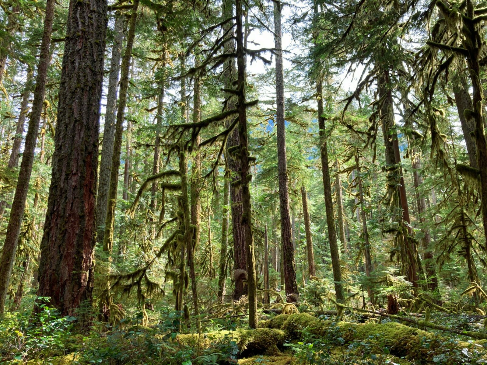
Middle Fork Snoqualmie River Trail – North Bend

The Middle Fork Trail offers an ideal hike for a rainy day or a winter day since you can turn around at any point and a forest and river hike is enjoyable in almost any weather.
- Location: Near North Bend at the end of the Middle Fork Road on Snoqualmie land about an hour from Seattle
- Best time of year: All year
- Length: Up to 10 miles round trip (turn around at any point)
- Elevation Gain: Up to 300 feet depending on how far you go
- Passes Needed: Northwest Forest Pass
- Dog friendly: Yes, on leash
- Cell phone service: None
- Restrooms: Pit toilets at trailhead
- Crowd avoiding tip: This hike is an ideal fall, winter and spring hike when it’s less busy.
- EV charging nearby: Fast charging at the North Bend outlet mall
- Best place to stop after: Pioneer Coffee in North Bend, North Bend Bakery (incredible cookies, pastries and breakfast sandwiches) or Volition Brewing in North Bend
Twin Falls – North Bend

Twin Falls is one of the most beautiful waterfall hikes near Seattle and is extremely popular, especially with families. The forest hike along the river with plenty of boulders and logs to climb on makes it fun for kids.
- Location: Near North Bend on Snoqualmie land about 45 minutes from Seattle
- Best time of year: Late fall through spring – this trail is extremely crowded on all days of the week in summer and is very popular with families. The waterfall is beautiful all year but the extra water in the wetter months and the lack of crowds make this an excellent winter hike.
- Length: 3 miles round trip (can add more miles going beyond the falls up to the Iron Horse Trail)
- Elevation Gain: 500 feet
- Passes Needed: Washington State Discover Pass
- Dog friendly: Yes, on leash
- Cell phone service: Mostly good
- Restrooms: Pit toilets at trailhead
- Crowd avoiding tip: This hike is fairly busy all year and on weekdays during the summer. This is a good evening option for summer, or November through March.
- EV charging nearby: Fast charging at the North Bend outlet mall
- Best place to stop after: Pioneer Coffee in North Bend, North Bend Bakery (incredible cookies, pastries and breakfast sandwiches) or Volition Brewing in North Bend
Franklin Falls – Snoqualmie Pass
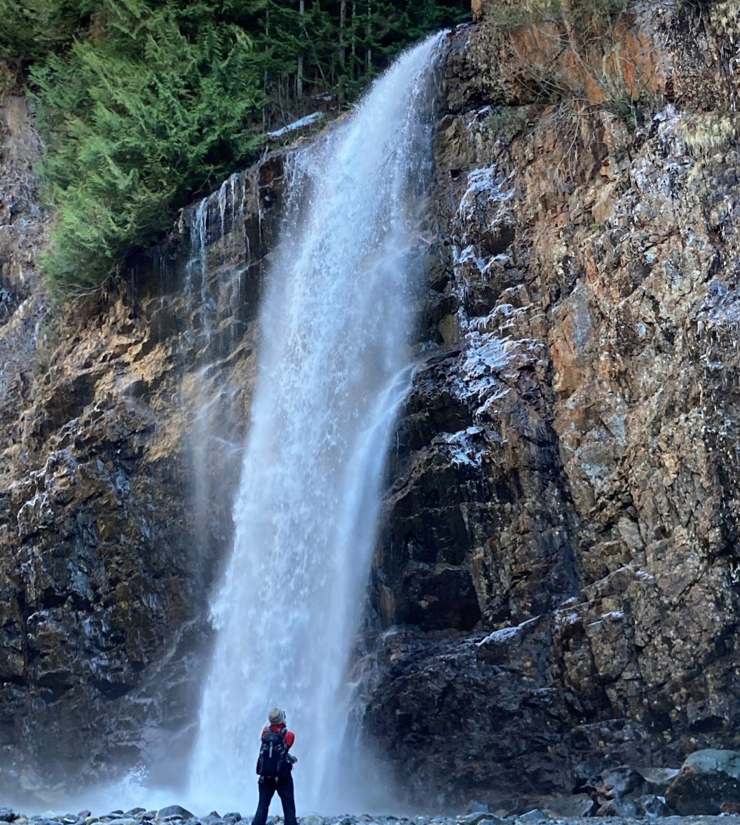
Franklin Falls is a famous and beautiful waterfall hike near Seattle that you’ll see all over the internet for good reason. This waterfall towers over the rocks and straight to more rocks below and is an unforgettable frozen scene in winter.
- Location: Franklin Falls is near Snoqualmie Pass on Snoqualmie Land about an hour from Seattle.
- Best time of year: The summer version of this hike is best from late June through early November. It’s also a stunning winter destination (December through February), learn more here about hiking to Franklin Falls in winter.
- Length: 2 miles round trip in summer
- Elevation Gain: 400 feet in summer
- Passes Needed: Northwest Forest Pass in summer (Washington Sno Park pass in winter)
- Dog friendly: Yes, on leash
- Cell phone service: Mostly good
- Restrooms: Pit toilet at trailhead in summer
- Crowd avoiding tip: Evenings are good in summer, or weekdays. Waterfalls are gorgeous on rainy days
- EV charging nearby: Fast charging at the North Bend outlet mall and at Snoqualmie Pass
- Best place to stop after: Pioneer Coffee in North Bend, North Bend Bakery (incredible cookies, pastries and breakfast sandwiches) or Volition Brewing in North Bend
Denny Creek Trail – Snoqualmie Pass
The Denny Creek Slides are a popular local swimming hole for generations of Seattleites. If you want to go further, there are a couple of waterfalls further up the trail.
- Location: Near Snoqualmie Pass on Snoqualmie Lands, about an hour from Seattle
- Best time of year: Late July through September for the slides – make sure the creek is low enough to safely cross to get to the slides
- Length: 4 miles round trip to the natural rock slides
- Elevation Gain: 400 feet (to the slides)
- Passes Needed: Northwest Forest Pass
- Dog friendly: Yes, on leash.
- Cell phone service: OK at the beginning, less service as you go up the trail
- Restrooms: Pit toilet in the parking lot
- Crowd avoiding tip: If you want to play in the waterslides, you can’t really avoid the crowds. This is a popular activity! Join the crowd, pack your patience for parking, and have a great time. Beyond the slides (after 2 miles) there are far fewer people on the trail.
- EV charging nearby: Fast charging at the North Bend outlet mall and at Snoqualmie Pass
- Best place to stop after: Pioneer Coffee in North Bend, North Bend Bakery (incredible cookies, pastries and breakfast sandwiches) or Volition Brewing in North Bend. At Snoqualmie Pass, a corn dog or hot drink from Bob’s Espresso or Dru Bru Brewery.
Talapus Lake – Snoqualmie Pass

Talapus Lake is the best mellow alpine lake hike near Seattle in the Alpine Lakes Wilderness.
- Location: Just west of Snoqualmie Pass on Snoqualmie Land about an hour from Seattle.
- Best time of year: June through November
- Length: 4 miles round trip (you can go further on the trail to Olallie, Pratt, Island and Rainbow Lakes for more miles)
- Elevation Gain: 1000 feet
- Passes Needed: Northwest Forest Pass
- Dog friendly: Yes, on leash
- Cell phone service: Some cell service in places, not everywhere
- Restrooms: Pit toilet in parking area
- Crowd avoiding tip: Evening hikes in summer, or weekdays or a rainy or cloudy day
- EV charging nearby: Fast charging at the North Bend outlet mall
- Best place to stop after: Pioneer Coffee in North Bend, North Bend Bakery (incredible cookies, pastries and breakfast sandwiches) or Volition Brewing in North Bend
Bridal Veil Falls – Highway 2

Bridal Veil Falls is a spur off the Lake Serene trail, a challenging hike. Getting to the waterfall involves a lot less climbing, but there are stairs in the last section to the waterfall. This is one of Washington’s most beautiful waterfalls.
- Location: Near the village of Index along Highway 2, on Skykomish and other Coast Salish People’s land. About an hour and a half drive from Seattle.
- Best time of year: April through November (watch for ice in winter months)
- Length: 4 miles round trip
- Elevation Gain: 1000 feet
- Passes Needed: Northwest Forest Pass
- Dog friendly: Yes, on leash
- Cell phone service: Limited to none
- Restrooms: Pit toilet at trailhead
- Crowd avoiding tip: This is a very busy and crowded trail in summer and on sunny weekends. Try an evening, weekday or spring or fall hike on a cloudy or rainy day (waterfalls make great rainy day hikes)
- EV charging nearby: Fast charging in Monroe
- Best place to stop after: Zeke’s Drive In – a drive in along Highway 2 that’s been an institution for decades
Barclay Lake – Highway 2
Barclay Lake is a beautiful and mellow hike to an alpine lake that’s ideal for beginners. At the time of this writing, the area is still closed due to a lengthly wildfire in late summer and fall of 2022. Hopefully this beautiful area will be open again soon.
- Location: Near the town of Skykomish along Highway 2, on Skykomish and other Coast Salish People’s land. About an hour and a half drive from Seattle.
- Best time of year: Spring and Fall. Summer is lovely but busy on this trail.
- Length: 4 miles round trip
- Elevation Gain: 500 feet
- Passes Needed: Northwest Forest Pass
- Dog friendly: Yes, on leash
- Cell phone service: None
- Restrooms: Pit toilet at trailhead
- Crowd avoiding tip: This is a popular and busy trail most of the summer. Spring and fall bring less crowds.
- EV charging nearby: Fast charging in Monroe
- Best place to stop after: Zeke’s Drive In – a drive in along Highway 2 that’s been an institution for decades
Ebey’s Landing Loop – Whidbey Island

Ebey’s Landing has views for miles across to the Olympic Mountains as well as to the Cascades. A historic farm, a bluff with eagles and a rocky beach are all here on Whidbey Island. Excellent sunset location.
- Location: land ack and land agency. distance from Seattle
- Best time of year:
- Length: 5.5 miles if you do the loop on the bluff and then the beach (can be a shorter going out and back)
- Elevation Gain: 300 feet on the whole loop (can be less if out and back)
- Passes Needed: Washington State Discover Pass (at the lower parking lot by the beach)
- Dog friendly: Yes, on leash
- Cell phone service: Good
- Restrooms: Pit toilets
- Crowd avoiding tip: Go in the evening or the winter to avoid lots of other hikers
- EV charging nearby: Fast charging in Everett and Burlington
- Best place to stop after: Penn Cove Brewing has beer, a big outdoor patio and some snacks. For a sit down meal, the Front Street Grill is a great option (especially if you want to try local mussels).
Bowman Bay Loop – Deception Pass State Park

Deception Pass has several excellent hikes, this one is good in any kind of weather! The Bowman Bay loop starts on the north side of the park and follows several small coves to views of the water through the forest and along beaches.
- Location: Deception Pass State Park, between Anacortes and Oak Harbor on the homeland of the Samish People. It’s about an hour and a half from Seattle.
- Best time of year: All year
- Length: 5 mile loop around Rosario Head and Bowman Bay
- Elevation Gain: 200 feet
- Passes Needed: Washington State Discover Pass
- Dog friendly: Yes, on leash
- Cell phone service: Good
- Restrooms: In the parking area
- Crowd avoiding tip: Deception Pass is the busiest state park in Washington, so going at a less busy time (avoiding school breaks and sunny weekends) is a good idea. You can also do this hike in the evening during the summer, when it’s much less busy.
- EV charging nearby: Fast charging in Burlington
- Best place to stop after: The Shrimp Shack or Bastion Brewing (also has food)
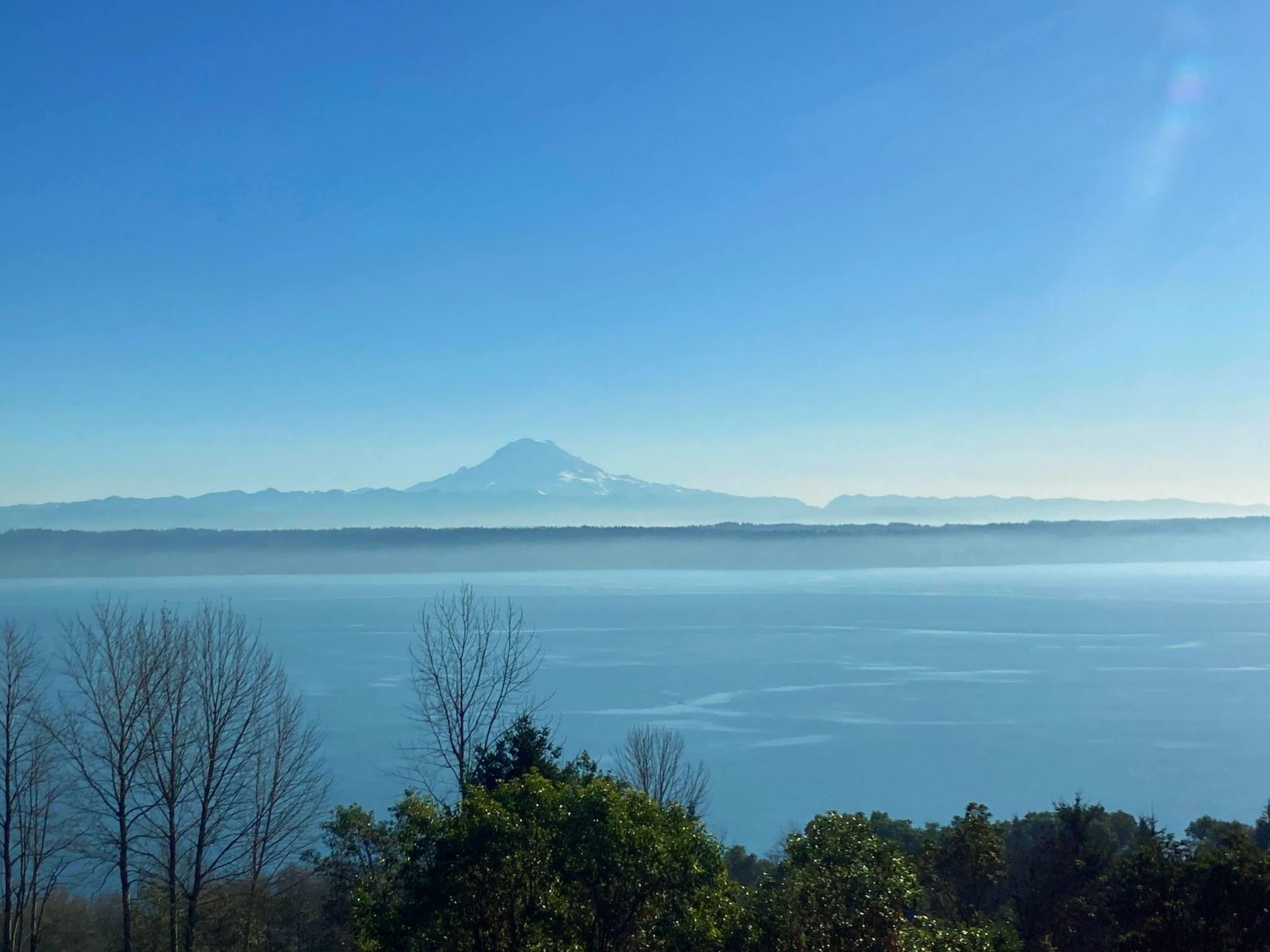
Oyster Dome – Bellingham
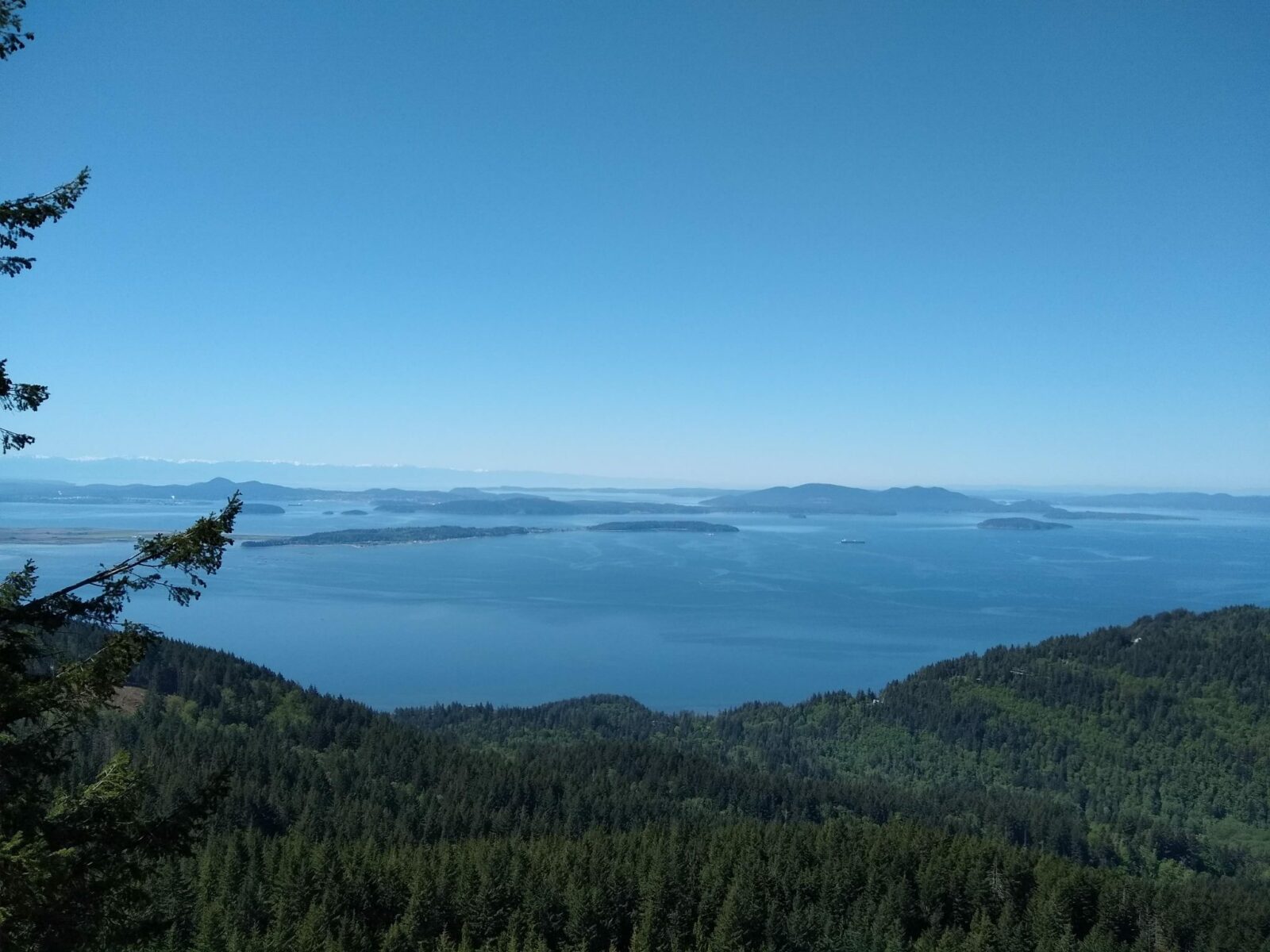
Oyster Dome is a beautiful view hike that is snow free most of the year, this hike takes you to a lookout over the Salish Sea and the San Juan Islands. Use caution with children at pets at the top where there’s a steep drop off.
- Location: Just south of Bellingham on Lummi and Skagit lands, about an hour and a half drive from Seattle.
- Best time of year: All year, unless there’s a lowland snow storm. Save this for a sunny day so you can see the view
- Length: 6 mile loop
- Elevation Gain: 1000 feet
- Passes Needed: Washington State Discover Pass
- Dog friendly: Yes, on leash (watch out at the top)
- Cell phone service: Mostly good
- Restrooms: Pit toilet at trailhead
- Crowd avoiding tip: Go on a sunny winter day, or later in the day or evening on summer weekends
- EV charging nearby: Bellingham and Burlington have fast chargers.
- Best place to stop after: The community of Bow has several farm to table restaurants, a delicious bakery and a brewery with excellent pizza.
Carbon River Trail – Mt Rainier National Park
As of Spring 2025, a bridge washout has caused an indefinite closure to the Carbon River Entrance of Mt Rainier National Park, including Carbon River Trails and Mowich Lake Trails. If the road reopens, I will update this article.
The Carbon River Trail is mostly along a closed and washed out road, which makes it very wide and flat or very gentle climbing. There is some climbing on a trail to get up to the waterfalls or Green Lake. There are no views of the mountain along this portion of the trail, the trade off is solitude.
- Location: land ack and land agency. distance from Seattle
- Best time of year: All year
- Length: Up to 10 miles round trip (turn around at any point)
- Elevation Gain: 650 feet to the campground, 1200 feet to Ranger Falls, 500 feet to Chenuis Falls
- Passes Needed: Mt Rainier entrance fee ($30/vehicle for up to 7 days) or America the Beautiful Pass. Pay entrance fee at the Carbon River Ranger Station. Display the pass while parking at the trailhead.
- Dog friendly: No, dogs are not allowed on any trails in Mt Rainier National Park
- Cell phone service: None
- Restrooms: Port a potties where you park, one is ADA accessible.
- Crowd avoiding tip: Crowds are not an issue here, this is a great place to find solitude.
- EV charging nearby: The nearest charging is in Puyallup.
- Best place to stop after: The Carlson Block for pizza, the Soda Shop for a soda fountain and ice cream experience in Wilkeson.
Naches Peak Loop – Mt Rainier National Park
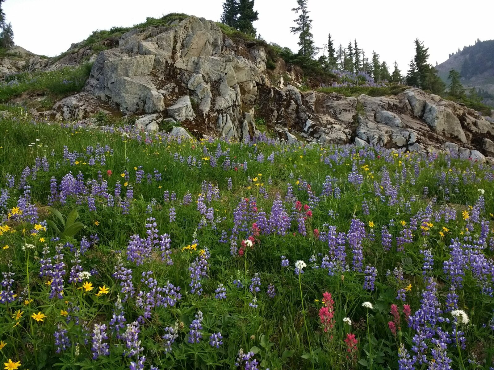
The Naches Peak Loop is one of the best hikes in Mt Rainier and as a bonus it’s a lot closer to Seattle than most of the hikes in the park. Colorful wildflowers and epic mountain views are abundant here.
- Location: Chinook Pass in Mt Rainier National Park, the homeland of the Yakama People.
- Best time of year: This hike is ideal in late July and early August during peak wildflower season. It also has some nice fall color in late September and early October.
- Length: 4 mile loop
- Elevation Gain: 600 feet
- Passes Needed: None
- Dog friendly: No, dogs are not allowed on trails in Mt Rainier National Park (one portion of the trail is out of the park along the Pacific Crest trail and does allow leashed dogs, but you cannot complete the loop with a dog)
- Cell phone service: None
- Restrooms: Pit toilets
- Crowd avoiding tip: Even in peak wildflower season, you will have complete solitude on this hike in the evening (after 6pm). Make sure to bring a headlamp. During the day this hike is very crowded.
- EV charging nearby: Yakima or Puyallup
- Best place to stop after: There aren’t any services close to Chinook Pass. The Pie Goddess in Enumclaw is a good stop for both sweet and savory pies (by the slice or to take home).
Discovery Park – Seattle

Discovery Park is a large city park on a bluff above the Salish Sea in the Magnolia neighborhood. Forests and bluffs as well as the Lighthouse are all highlights of this park. The park is also the location of the United Indians of All Tribes occupation in 1970, when the land of the former Fort Lawton was being surplussed by the military according to treaties between local tribes and the US government. This led to a portion of the land becoming the United Indians of All Tribes headquarters, where it is today at the Daybreak Star Cultural Center. The Center has served Urban Indians in Seattle since the 1970s.
- Location: Discovery Park is a City of Seattle park.
- Best time of year: All year.
- Length: A 3 mile loop takes you through the various landscapes and views of the park, though there are many additional miles of trails if you’d like to explore further
- Elevation Gain: a few hundred feet around the loop
- Passes Needed: None
- Dog friendly: Yes, on leash
- Cell phone service: Good
- Restrooms: Several locations with both restrooms and port a potties, at the time of this writing, ADA restrooms are being built at the visitor center. The project is scheduled to be completed in June 2023.
- Crowd avoiding tip: The park gets really crowded, especially on sunny weekends. Try visiting early in the morning or in the evening on weekends, or during the day on weekdays. Avoid parking hassles by taking the city bus here.
Seward Park – Seattle

Seward Park has a surprisingly un-urban feel for being right in the heart of South Seattle. There’s a flat, wide paved loop that takes you along the edge of the lake on a peninsula sticking out into Lake Washington with views of Tahoma (Mt Rainier), Mercer Island and downtown Seattle. There are also several miles of dirt trails in the center of the park.
- Location: Seward Park is a City of Seattle park in the Southeast corner of the city on Duwamish Land.
- Best time of year: All year. Expect plenty of people and difficult parking on weekends all year.
- Length: 2.5 mile loop around the park, many additional miles of trails in the interior of the park.
- Elevation Gain: None on the loop
- Passes Needed: None
- Dog friendly: Yes, on leash
- Cell phone service: Good
- Restrooms: At the main entrance with port a potties in a few other locations, ADA accessible
- Crowd avoiding tip: The park gets very crowded, but there are rarely any people on the trails in the interior of the park. Avoid parking hassles by taking the bus here.
Cowiche Canyon – Yakima

Including Cowiche Canyon on this list is cheating slightly because it’s about 3 hours from Seattle. This hike is so unique and a totally doable day hike from Seattle that it has to be included. Here you can hike through a canyon showcasing central Washington’s unique geology and then hike up the side of the canyon to a winery!
- Location: Near Yakima, on the land of the Yakama People.
- Best time of year: Spring (April and May) or fall (October and November) are the ideal times, though this is good hike all year. It can get icy in winter and is very hot in summer. Spring has gorgeous wildflowers and fall has beautiful fall color.
- Length: Up to 6 miles round trip
- Elevation Gain: 100 feet if going up to the winery, none in the canyon
- Passes Needed: None
- Dog friendly: Yes, on leash
- Cell phone service: Good
- Restrooms: Port a potty at trailhead, restrooms at the winery
- Crowd avoiding tip: I’ve never seen this hike crowded so no need to worry about it.
- EV charging nearby: Yakima and Ellensburg have multiple fast chargers.
- Best place to stop after: Los Hernandez Tamales in Union Gap, or any taco truck. The Public House of Yakima for beer.
Best Mellow Hikes in Olympic National Park
Olympic National Park has plenty of mellow hikes that let you experience the diversity of landscapes in the park. A few favorites:
- Sol Duc Falls – open seasonally when the Sol Duc Hot Springs road is open, in addition to the forest and epic waterfall you can also enjoy a soak in the nearby hot springs.
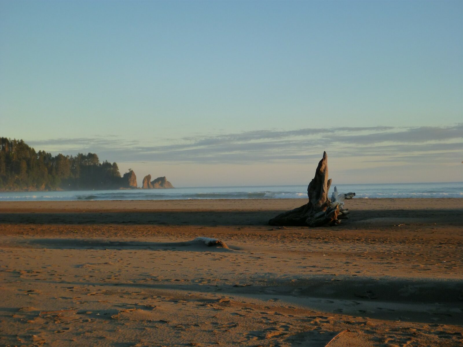
- Second Beach – any of the beaches in Olympic National Park are excellent mellow hikes and I particularly love second beach. See old growth forest on the way to a remote coast full of tidepools and beautiful sunsets. An excellent beginner backpacking destination.
- Hoh River Trail – The world famous Hoh Rainforest has a short and flat nature trail as well as a trail that goes far up the Hoh River Valley through ancient and giant trees. Watch for elk as well. Also a good beginner backpacking trip, except for the rain (get a permit from the ranger station).
- Marymere Falls – travel through old growth forest along Barnes Creek to lovely Marymere Falls. The trail is flat except for the last short bit up to the waterfall, which is quite steep (but very short)
- Hurricane Hill – one of my favorite hikes in the park, this gives you epic high alpine mountain views all the way to Canada in a short distance. This is also a beautiful winter snowshoe.
Best Mellow Hikes in North Cascades National Park
North Cascades National Park is a three to four hour drive from Seattle, depending on exactly where you go. There are many excellent hikes here. My favorite mellow ones (less than 1000 feet of elevation gain) are:
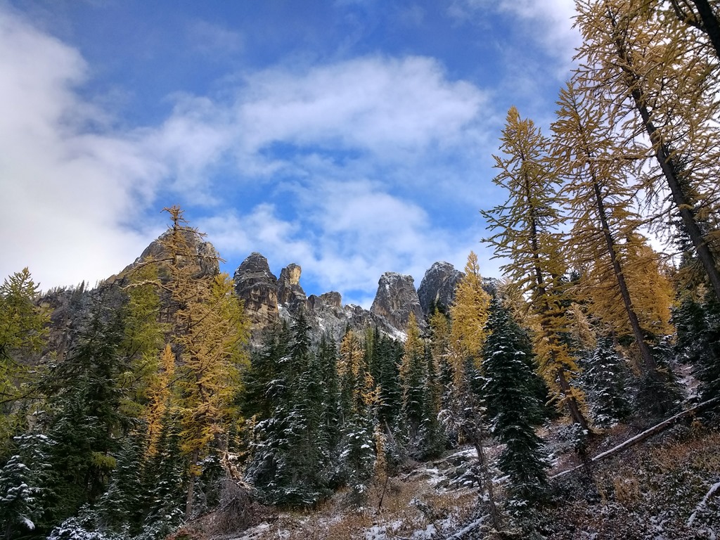
- Blue Lake – 4 miles round trip with about 1000 feet of elevation gain. This hike has it all – beautiful forest, epic views of the North Cascades and a lovely alpine lake ringed with golden larches in the fall.
- Thunder Knob – Less than 4 miles round trip and about 400 feet of elevation gain leads you to a viewpoint of impossibly turquoise Diablo Lake.
- Thunder Creek – This is an ideal beginner backpacking trip, since it doesn’t have much elevation gain (get a permit from the rangers first). It also makes a wonderful day hike, just make sure to set a turn around time since it’s 12 miles round trip. You can turn around at any point and have a beautiful river and forest hike with very few people.
Related posts:


